Why this winter has been so warm
The weather we experience in the Northland, depends on what the larger weather pattern sends our way. This determines where the cold air is and where the warm air is. To put it simply, the reason this winter has been so warm and snowless is that we’ve had a lot of prevailing patterns that have kept us under a warm and dry regime. This is largely due to El Niño.
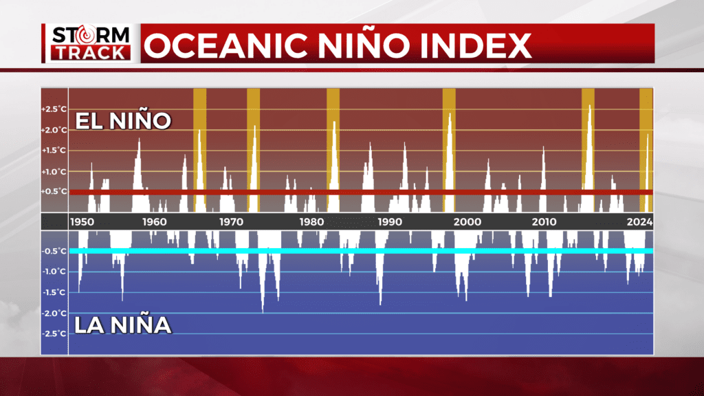
Let’s look at the Oceanic Niño Index. Think of this as a plot going back to 1950 showing El Niño in peaks above the red line and La Niña in peaks below the blue line. The current El Niño began in the summer. You can see spikes from the past of 5 other winters that had stronger El Niño than we have right now.

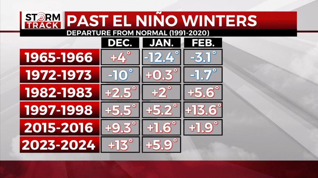
It’s interesting to look back at how those played out. The winter of 1965 to 1966 had a warm December, but a very cold January and a cold February. 1972 to 1973 had a very cold December, average January, and cool February. Then starting with the 1982 to 1983 winter, each month was warmer than the current normal by at least two degrees. 1997 to 1998 was warm all around with an extremely warm February. Then 2015 to 2016 brought a very warm December followed by a less impressive January and February. This winter has outperformed each of these five examples in warmth so far.
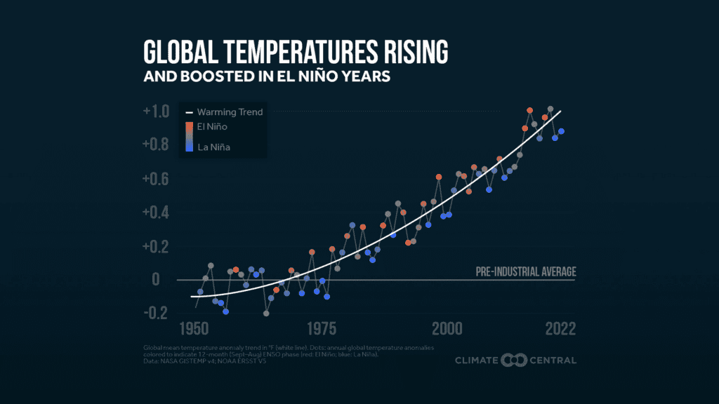
Let’s plot the El Niño Southern Oscillation on top of the global temperature trend.

The data shows us that the planet’s temperature has been rising in recent decades. As the baseline rises, the typical warming effect of El Niño is enhanced, which is what we’ve seen so far this winter.
