Justin Liles: Storms this evening, better chance out west
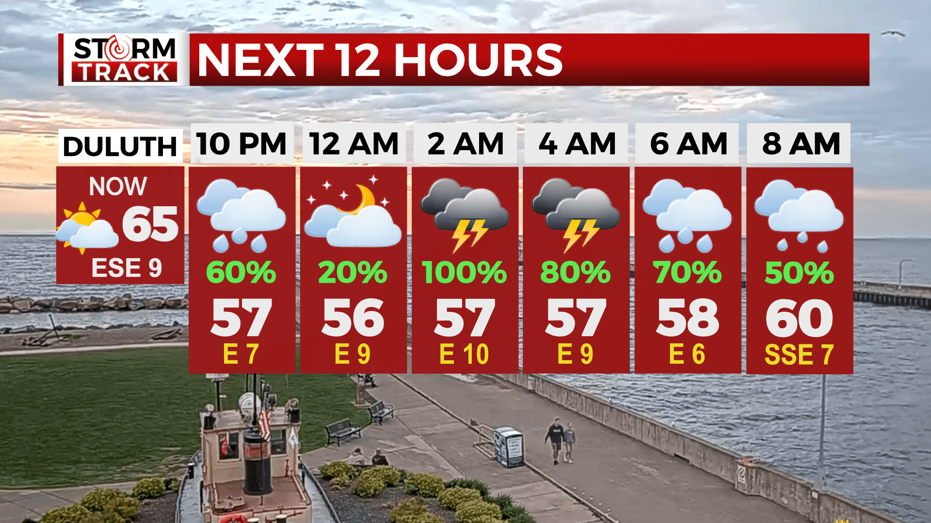
A cold front will move through with strong to severe thunderstorms, especially in the late afternoon and evening. Damaging winds to 70 mph are the primary threat with large hail and an isolated tornado also possible. Heavy rain with the cold front moving through this evening into tonight will lead up to 1.0 inch in portions of the Northland.
Due to saturated soils, some localized ponding and minor flooding are possible. Wet weather looks to stick around this week. There is another stronger system set to roll through again on Tuesday. Another round of strong storms could arrive by the evening hours. By Wednesday, more storms are possible during the evening and winds will become rather breezy through the end of the week. Sunshine does looks to return this weekend by be on the cooler side in the 60s.
Tonight
A chance of showers and thunderstorms, then showers and possibly a thunderstorm after 11pm. Low around 56. Southeast wind around 10 mph, with gusts as high as 15 mph.
Monday
A 40 percent chance of showers and thunderstorms, mainly before noon. Mostly cloudy, with a high near 73. South wind around 10 mph, with gusts as high as 15 mph.
Tuesday
A chance of showers and thunderstorms all day. High near 71. East wind 5 to 10 mph, with gusts as high as 20 mph.
Wednesday
Mostly sunny with isolated thunderstorms and a high near 72. Breezy, with a west wind 10 to 15 mph, with gusts as high as 25 mph.
Thursday
A slight chance of showers. Mostly sunny, with a high near 63. Breezy, with a west wind 15 to 20 mph, with gusts as high as 35 mph.
Friday
Mostly sunny, with a high near 65. Breezy, with a northwest wind 15 to 20 mph, with gusts as high as 30 mph.
Saturday
A slight chance of showers. Mostly sunny, with a high near 64. Breezy, with a northwest wind 10 to 15 mph, with gusts as high as 20 mph.