Justin Liles: Slowly cooling down with storms possible Saturday afternoon and evening
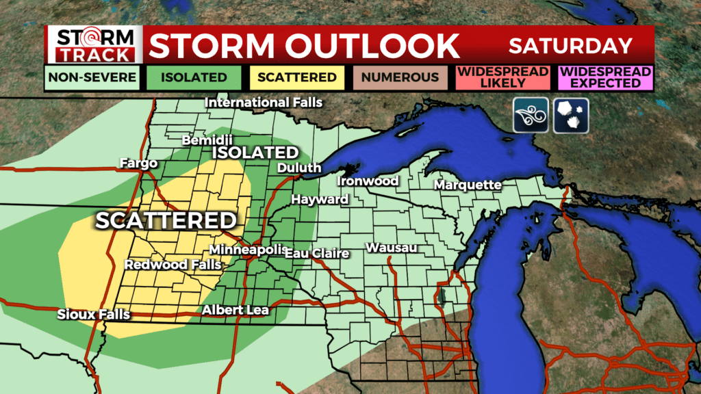
Hot temperatures have been in the 80s all day with westerly winds. This has made temperatures downtown reach over 90°F. Tomorrow cooler and drier air begins to build in. Saturday afternoon and evening, a front sweeps across the region from northwest to southeast bringing a chance of strong storms. Strong to severe storms are possible Saturday afternoon and evening as a cold front moves south through the area. The main threat will be for large hail and damaging winds. There is only a very low risk of tornados.
Sunday, a band of showers and thunderstorms are possible, but it is uncertain exactly where it will set up. Heavy rain likely where that band ends up. No significant strong winds expected outside of thunderstorms. Cooler weather continues into next week.
TONIGHT
Clear, with a low around 58. Northwest wind around 5 mph.
SATURDAY
A slight chance of showers between 3pm and 4pm, then a chance of showers and thunderstorms after 4pm. Increasing clouds, with a high near 84. Northwest wind 5 to 10 mph becoming southwest in the morning. Winds could gust as high as 15 mph.
SUNDAY
A slight chance of thunderstorms before 7am. Mostly sunny, with a high near 76. Northeast wind 5 to 10 mph.
MONDAY
A chance of showers. Mostly cloudy, with a high near 71. East wind 5 to 10 mph, with gusts as high as 15 mph.
TUESDAY
Sunny, with a high near 75. East wind around 5 mph.
WEDNESDAY
A slight chance of showers. Partly sunny, with a high near 73. East wind 5 to 10 mph becoming south in the morning. Winds could gust as high as 15 mph.
THURSDAY
A chance of showers. Partly sunny, with a high near 69. East wind 5 to 10 mph becoming west in the morning. Winds could gust as high as 15 mph.