Sabrina Ullman: Cooler Monday with a chance of rain
Tonight will have cloudy skies with a light east wind becoming north after midnight. Overnight lows will be in the upper 40s along the Iron Range and in the 50s elsewhere. There is a chance of rain west of Aitkin County.
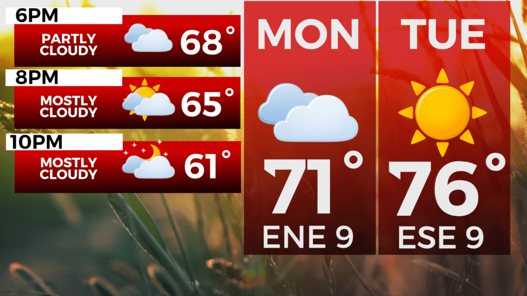
Monday will be around 20 degrees cooler than it was this past Friday with afternoon highs near 70 degrees. Rain is likely for areas southwest of a line from Moose Lake to Hayward.
Tuesday will be sunny with highs in the upper 70s. We cool back down to the low 70s Wednesday-Friday with intermittent rain chances.
Tonight
A 30 percent chance of showers, mainly before midnight. Mostly cloudy, with a low around 55. East wind around 5 mph becoming north after midnight.
Monday
A 30 percent chance of showers, mainly after 3pm. Mostly cloudy, with a high near 71. East wind 5 to 10 mph.
Tuesday
Sunny, with a high near 76. North wind around 5 mph becoming east in the afternoon.
Wednesday
A slight chance of showers after 1pm. Partly sunny, with a high near 74. South wind 5 to 10 mph, with gusts as high as 15 mph.
Thursday
A chance of showers and thunderstorms. Partly sunny, with a high near 72. West wind 5 to 10 mph, with gusts as high as 15 mph.
Friday
A slight chance of showers. Mostly sunny, with a high near 72. North wind 5 to 10 mph, with gusts as high as 15 mph.
Saturday
Mostly sunny, with a high near 74. North wind 5 to 10 mph.
Sunday
A slight chance of showers. Mostly sunny, with a high near 77. Northwest wind 5 to 10 mph becoming northeast in the afternoon.