NWS: EF-1 tornado traveled nearly 6 miles near Canyon and Cotton

Tornado near Cotton, Kyle Dodds
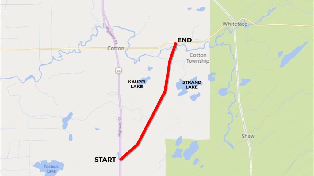
The National Weather Service in Duluth has finished its preliminary Storm Damage Survey of a tornado that passed through the Canyon and Cotton area in central St. Louis County on Thursday evening.
“Since we got an overwhelming amount of pictures and videos and reports from people right around Cotton basically, we went up and did a storm survey today,” said NWS Meteorologist Josh Sandstrom. “From that, we were able to draw an approximate path of where the tornado went based on the damage that we saw.”
According to the report, an EF-1 tornado formed at 5:05 p.m. Thursday and stayed on the ground until 5:18 p.m. The National Weather Service says peak winds were estimated at 105 mph and the tornado made a path of 5.9 miles, with a max width of 200 yards.
The National Weather Service reminds the public that numerous funnel clouds were reported from other storms, however the Canyon/Cotton storm is the only storm to produce a confirmed tornado at this time.
St. Louis County Emergency Management, Carlton County Emergency Management, Skywarn Spotters and the public helped to gather information.
“We just want to thank our local emergency managers, especially in St. Louis and Carlton Counties, for helping us out, getting us information about where damage was o we kind of had an idea of where to look,” said Sandstrom. “We especially appreciate all the information, the pictures, videos, and just people calling in and sending us messages on social media, just letting us know what happened, where it happened, our trained spotters, everybody like that.”
Severe weather moved across the region on Thursday afternoon.
Here are some official storm reports sent to the National Weather Service:
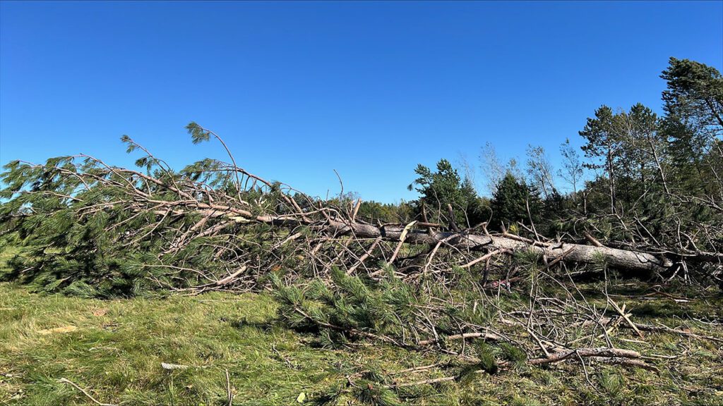
- 5:05 PM – 4 pine trees 1 foot in diameter snapped 10 feet up from the base – 4 N Canyon – St. Louis County
- 5:06 PM – Several trees 1 foot in diameter blown onto Three Lakes Road – 4 N Canyon – St. Louis County
- 5:08 PM – At least 35 pine trees snapped at the base on the north side of Bug Creek Road – 2 ESE Cotton – St. Louis County
- 5:14 PM – roof shingles torn off two-story home – 1 ESE Cotton – St. Louis County
- 4:20 PM – 0.88 inch hail reported – 6 NNW in Ely – St. Louis County
- 5:30 PM – 1.00 inch hail reported – Sturgeon Lake – Pine County
- 5:30 PM – 1 inch hail reported – Barnum – Carlton County
- 5:40 PM – 1.50 inche hail reported – 2 E Mahtowa – Carlton County (damage to cars on I-35)
- 5:45 PM – 1.25 inch hail reported – 2 NW Nemadji – Carlton County
- 5:55 PM – 1.00 inch hail reported – 3 SE Brookston – St. Louis County
- 7:20 PM – 0.88 inch hail reported – 1 SSE Yellowlake – Burnett County