Lea Zmurko: A mid-week chill
Waking up with cooler weather as a few scattered showers and mixed winter precipitation will cross the arrowhead in the early morning, but skies will be dry by the afternoon. No snow accumulation today as the ground is still too warm.
Temperatures have fallen 20-25 degrees in the past 24 hours as a cold front crossed the Northland overnight. With winds form the north, conditions will feel cooler throughout the afternoon, so an extra layer or hat and gloves may come in handy especially in the early morning.
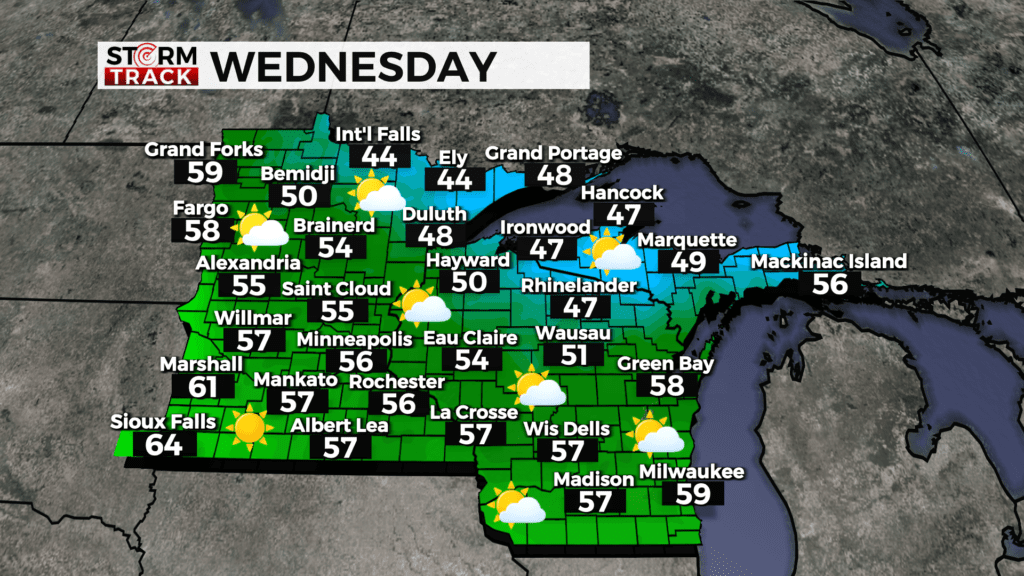
Rain will return will on Thursday as showers stretch from Brainerd Lakes to Lake Superior. The weekend will be dry as high pressure returns and temperatures climb into the mid-50s.
Today
Mostly sunny, with a high near 48. Breezy, with a northwest wind 10 to 15 mph, with gusts as high as 25 mph.
Tonight
Increasing clouds, with a low around 38. Southwest wind 5 to 10 mph, with gusts as high as 20 mph.
Thursday
Showers after 1pm. High near 58. Breezy, with a southwest wind 10 to 15 mph, with gusts as high as 20 mph. Chance of precipitation is 80%. New precipitation amounts between a tenth and quarter of an inch possible.
Friday
Sunny, with a high near 54. Breezy, with a northwest wind 10 to 15 mph, with gusts as high as 25 mph.
Saturday
Sunny, with a high near 52. West wind 5 to 10 mph, with gusts as high as 15 mph.
Sunday
Sunny, with a high near 56. Breezy, with a southeast wind 5 to 15 mph, with gusts as high as 25 mph.
Monday
Mostly sunny, with a high near 63. Breezy, with a south wind 10 to 15 mph, with gusts as high as 25 mph.
Tuesday
A chance of showers. Mostly cloudy, with a high near 66. South wind around 10 mph becoming southwest in the afternoon. Winds could gust as high as 20 mph.