Breaking down the timeline for April Fools’ Day storm

Another strong spring/winter storm will make giant impacts on the region tonight through Thursday morning
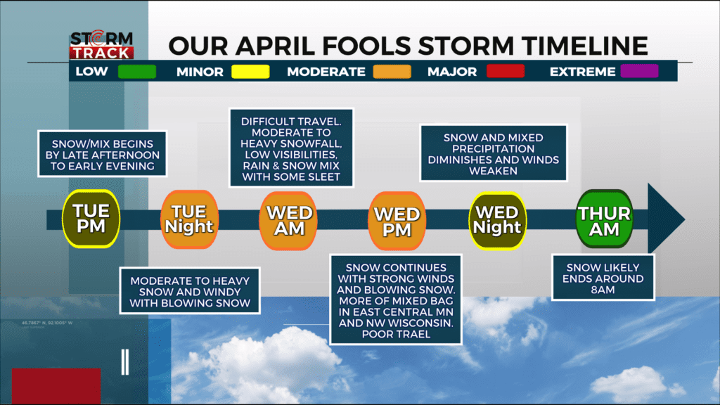
TUESDAY NIGHT INTO WEDNESDAY MORNING
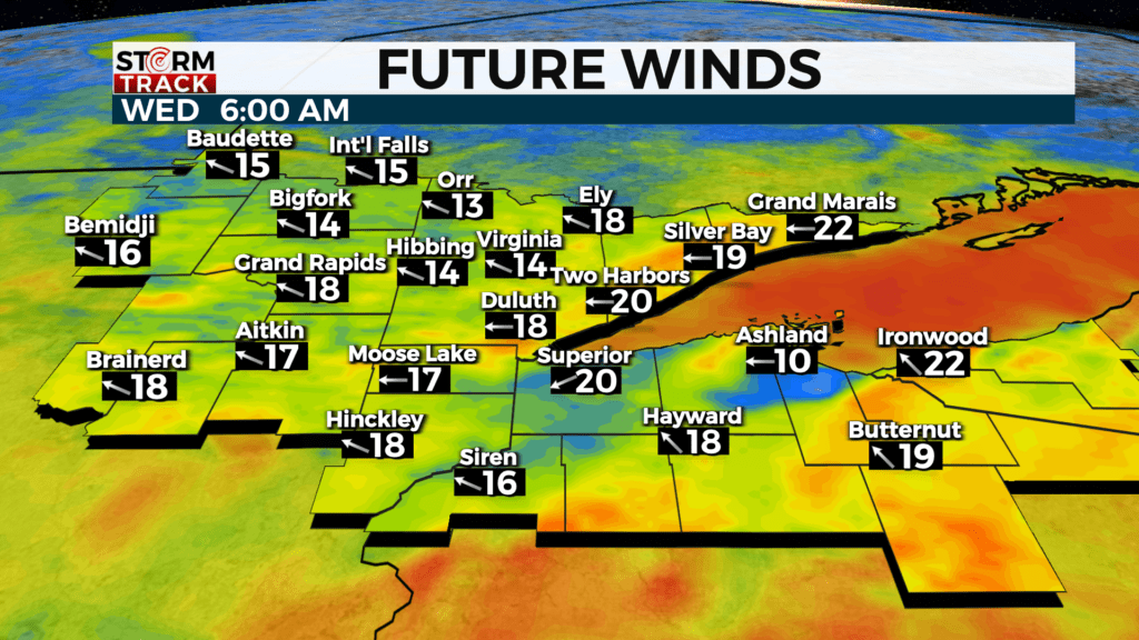
*What will start off as a wintry mix will eventually turn over to snow. Winds off the lake will be gusty leading to poor travel

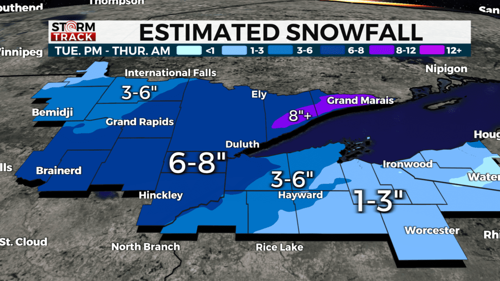
*These amounts may change depending on the amount of mixed precipitation that occurs.
- A wintry mix will turn over to rain, creating moderate to heavy snow.
- Wind speeds will increase, creating poor visibility and travel Wednesday morning
- Drier air off lake should help to limit snowfall totals

WEDNESDAY

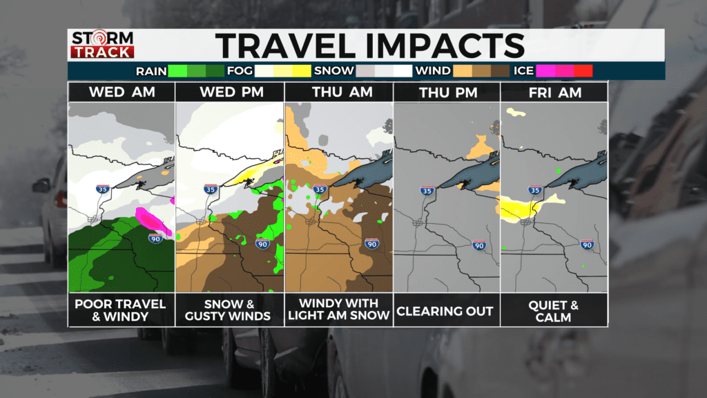
- Strong winds creating blowing snow will likely create terrible all day Wednesday
- A wintry mix is likely for east central Minnesota and west central Wisconsin. Some parts of northern Wisconsin may see some light freezing rain.
WEDNESDAY NIGHT INTO THURSDAY MORNING
Travel could still be a bit slick during the morning hours. Winds will continue to be blustery too. Snow, along with any lingering mixed precipitation, will diminish.