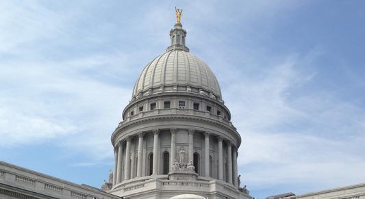
Census numbers kick off Wisconsin redistricting battle

[WDIO-TV/File]
MADISON, Wis. (AP) – Wisconsin’s redistricting battle shifted into high gear Thursday with the release of detailed census numbers expected to show a growing diverse population in urban areas, rural population losses and other shifts that will determine congressional boundary lines and what parts of the state gain or lose seats in the Legislature.
Wisconsin’s overall population grew by nearly 4%, enough for the state to keep its eight existing congressional districts but not enough for it to gain a ninth seat. The state’s white population dropped by 3.4%, while the Hispanic population grew by 33.1%, or about 111,000 people. The Black population grew by 4.8%, or about 17,000 people.
Republicans drew the maps in 2011 and will once again be in charge by virtue of their legislative majority. New lines will be drawn for the state’s eight congressional districts, 99 Assembly seats and 33 Senate districts.
But unlike in 2011, when Republican Gov. Scott Walker signed the GOP-drawn maps into law, the Legislature this time will have to win over Democratic Gov. Tony Evers. If, as expected, Evers vetoes the maps, it would be up to the courts to decide the lines. It’s also likely there will be lawsuits filed before the Legislature even completes its work.
Republican Assembly Speaker Robin Vos said Thursday he was confident the Legislature would pass maps that would win Evers’ approval. He also announced a new website where anyone can submit maps between Sept. 1 and Oct. 15.
Republicans have already asked the Wisconsin Supreme Court to take any lawsuits directly, a request the court rejected. That means any state lawsuits will have to start in circuit court, but they’re expected to make their way to the state Supreme Court. Challenges in federal court, particularly over claims that Black people and other racial minorities are denied political power through gerrymandering, are also likely.
Evers created a commission he said was nonpartisan to draw its own maps for the Legislature to consider. That group has been meeting for nearly a year, but the Legislature is not required to consider its maps. However, the maps likely will be submitted as a possible alternative for a court to consider.
Democrats and their allies unsuccessfully tried to overturn the Republican-drawn maps a decade ago, arguing they were an illegal gerrymander that secured a GOP majority in the Legislature. Republicans were able to increase their majorities in the Legislature under the maps they drew, even as Democrats won statewide races for governor and U.S. Senate in 2018 and President Joe Biden defeated Donald Trump in the state in 2020.
Republicans are already arguing that because of Wisconsin’s relatively small population shift over the past decade, few changes will be needed to the maps this year. Liberals and their allies argue that the existing maps are so gerrymandered to benefit Republicans that they should be tossed and new ones drawn based on what was in place prior to 2011.
Joe Handrick, a former Republican state lawmaker who helped draw the maps a decade ago and now works for a conservative advocacy group, tweeted this week that based on 2019 census population estimates, the amount of shifting in Wisconsin “will be much less than it has been in recent decades.”
“This means most map adjustments can be relatively minor,” he said.
The city of Milwaukee will likely lose less population than in past redistricting rounds, while suburban growth will also be less, Handrick said. The biggest population gains are likely to be in and around Madison, he said. The Green Bay-Appleton area should also see modest growth, he said.
There will be increased diversity in Wisconsin’s population, which will need to be addressed in the new maps, said Doug Poland, an attorney who challenged the existing maps in a case that ended up in the U.S. Supreme Court.
Wisconsin’s legal challenge died after the U.S. Supreme Court in 2019 ruled in cases from Maryland and North Carolina that claims of partisan gerrymandering are inherently political questions the federal courts cannot address. That means gerrymandering lawsuits will be decided by state courts.
Local political boundary lines at the municipal and county level also must be redrawn. Evers vetoed a Republican bill that would have delayed implementation of local redistricting until 2023 to give officials more time to draw the lines, saying new districts need to be created as soon as possible to reflect population changes over the past decade.
Local officials had argued for the bill, saying it would be difficult if not impossible to complete redistricting by Nov. 23, as is required by law.
(Copyright 2021 The Associated Press. All rights reserved. This material may not be published, broadcast, rewritten or redistributed without permission.)