Justin Liles: Getting warmer with a little hiccup on Wednesday

High pressure will be in control for a day. Tuesday is still looking cooler, but we will see plenty of sunshine. On Wednesday, a small piece of energy will drop south out of Canada and bring in a light mixed bag of precipitation to the area, but the Arrowhead. The temperatures here look to stay cool enough to bring mostly snow. A little dusting is all that is expected.
Drier conditions and warming temperatures will climb through the weekend, though winds will be light under another high pressure. Temperatures are expected to climb into the upper 50s and lower 60s, and we’ll see plenty of sunshine. Sunshine is expected through the weekend with a chance of rain late Sunday.
TONIGHT
Mostly clear, with a low around 14. North wind 5 to 10 mph becoming light after midnight.
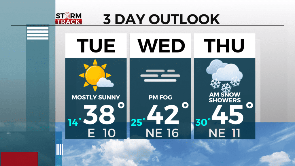
TUESDAY
Sunny, with a high near 38. Calm wind becoming southeast around 5 mph in the afternoon.
WEDNESDAY
A chance of wintry mix. Mostly cloudy, with a high near 40. East wind 5 to 10 mph, with gusts as high as 15 mph.
THURSDAY
A slight chance of rain and snow before 1pm. Partly sunny, with a high near 46. Northeast wind 5 to 10 mph, with gusts as high as 15 mph.
FRIDAY
Mostly sunny, with a high near 54. Northwest wind 5 to 10 mph.
SATURDAY
Mostly sunny, with a high near 59. South wind 5 to 10 mph, with gusts as high as 15 mph.
SUNDAY
A chance of rain. Partly sunny, with a high near 59. Breezy, with a southeast wind 10 to 15 mph, with gusts as high as 20 mph.