Justin Liles: Saying goodbye to warmth and hello to a wintry mess
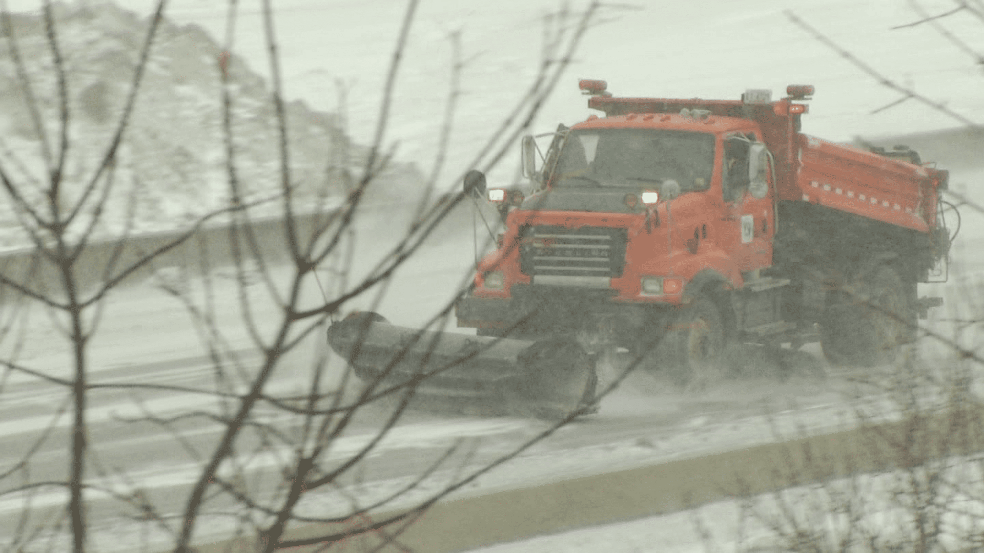
What a way to start off the work week! Temperatures were well above average, and we saw a bunch of sunshine. Over the next 24-48 hours old man winter is back from vacation. The Storm Track Weather Team has been monitoring a wintry mess heading toward the Northland. It all starts off tonight with light rain potentially turning over into freezing rain. It will likely be followed by more rain before turning over to snow with gusty winds and poor visibility. Here is the situation we are currently dealing with Tuesday and Wednesday. Please keep in mind many Northlanders will be traveling to the Boys State Hockey Tournament during this period.
Freezing Rain: Currently, freezing rain looks to start tonight in NE Minnesota. The ice track is still in question but could swing farther north impacting Ely, Grand Marais, and Grand Portage. The Twin Ports as well as Two Harbors may see accumulations heading into Tuesday morning.
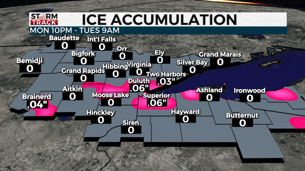
Rain: The region will start off as rain tonight first before turning over to freezing rain, the turning back over to rain before noon Tuesday.
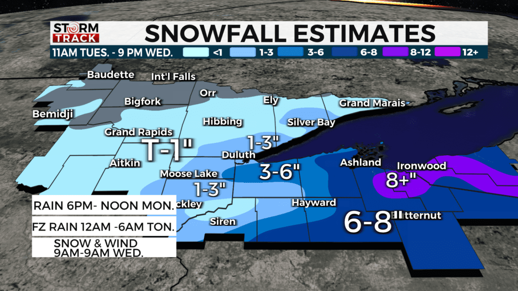
Snow: Heavy snow along with strong winds take over beginning Tuesday afternoon. Snow along with poor visibilities will likely create problems through most of Thursday. There could also be downed power lines and school delays or cancellations by Wednesday morning.
Milder conditions will return to take us through the end of the weekend and into the weekend. Make sure to watch Chief Meteorologist Justin Liles at 5,6, &10pm and Lea Zmurko 5-7 am on Good Morning Northland for any further details.
TONIGHT
Rain likely, mainly after 3am. Mostly cloudy, with a low around 32. East wind around 5 mph.
TUESDAY
Snow, possibly mixed with rain, becoming all snow after 2pm. High near 36. Breezy, with a northeast wind 5 to 15 mph, with gusts as high as 20 mph.
TUESDAY NIGHT
Snow. Patchy blowing snow after 1am. Low around 22. Blustery, with a north wind 10 to 20 mph, with gusts as high as 30 mph.
WEDNESDAY
A 50 percent chance of snow before noon. Patchy blowing snow before 3pm. Mostly cloudy, with a high near 29. Blustery, with a north wind 15 to 20 mph, with gusts as high as 35 mph
THURSDAY
Mostly sunny, with a high near 37. Breezy, with a west wind 5 to 15 mph, with gusts as high as 20 mph.
FRIDAY
Sunny, with a high near 32. Northwest wind 5 to 10 mph, with gusts as high as 15 mph.
SATURDAY
A slight chance of snow. Partly sunny, with a high near 34. Northwest wind 5 to 10 mph, with gusts as high as 20 mph.
SUNDAY
Mostly sunny, with a high near 41. Breezy, with a west wind 10 to 15 mph, with gusts as high as 20 mph.
MONDAY
Mostly sunny, with a high near 45. West wind 5 to 10 mph becoming south in the afternoon. Winds could gust as high as 20 mph.