Justin Liles: Snow in parts of the Northland tonight
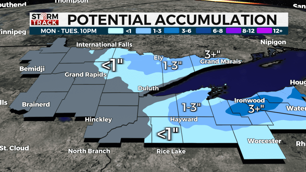
Cooler air has moved in following a half-and-half weekend. Saturday was absolutely beautiful, and last night the rain and cooler temperatures returned. A passing area of low pressure pushing from Minnesota to western Ontario will create a band of lake effect snow to develop towards the U.P. of Michigan. These areas are under a Winter Storm Warning until 10 am Tuesday.
Winds will continue to be rather breezy, but more sunshine will prevail by the afternoon hours. Temperatures will continue to climb through the rest of the week. Rain will return on Thursday, and we may get to see a few thunderstorms. No severe weather is likely. Temperatures will warm into the 50s again this weekend with plenty of sunshine. Some areas may get into the 60s.
TONIGHT
Rain and snow showers likely, mostly cloudy, with a low around 29. Blustery, with a northwest wind around 20 mph, with gusts as high as 35 mph.
TUESDAY
Mostly cloudy, then gradually becoming sunny, with a high near 45. Breezy, with a northwest wind 15 to 20 mph, with gusts as high as 30 mph.
WEDNESDAY
Mostly sunny, with a high near 49. Light east wind becoming southeast 5 to 10 mph in the morning. Winds could gust as high as 20 mph.
THURSDAY
Showers likely, mainly after 1 pm. Partly sunny, with a high near 56. East wind around 10 mph, with gusts as high as 20 mph.
FRIDAY
A slight chance of showers. Mostly cloudy, with a high near 52. Breezy, with a northwest wind 10 to 15 mph, with gusts as high as 25 mph.
SATURDAY
Mostly sunny, with a high near 50. Northwest wind 5 to 10 mph, with gusts as high as 15 mph.
SUNDAY
Mostly sunny, with a high near 56. Breezy, with a southeast wind 5 to 15 mph, with gusts as high as 20 mph.