Justin Liles: Sunshine and drier through the weekend
Most of the Northland spent the day cleaning up from our April Fools’ snowstorm mess. The North Shore was the area that received the most snow. Warmer temperatures and sunshine did help in melting our snow. Northwesterly winds this evening will become calm to give way to southwesterly winds tomorrow morning ahead of the next incoming cold front Friday evening. A trace to just over an inch of new snowfall is expected mainly in northern Minnesota Friday night ahead of the cold front crossing over the region Saturday morning. As this weak clipper moves through, most of us will see a shift back to northwesterly winds Saturday afternoon. Behind the front, temperatures will cool down back into the 30s. High pressure will take over, and we will see plenty of sunshine through the weekend. The U.P. of Michigan may see some lake effect snow Sunday night into Monday.
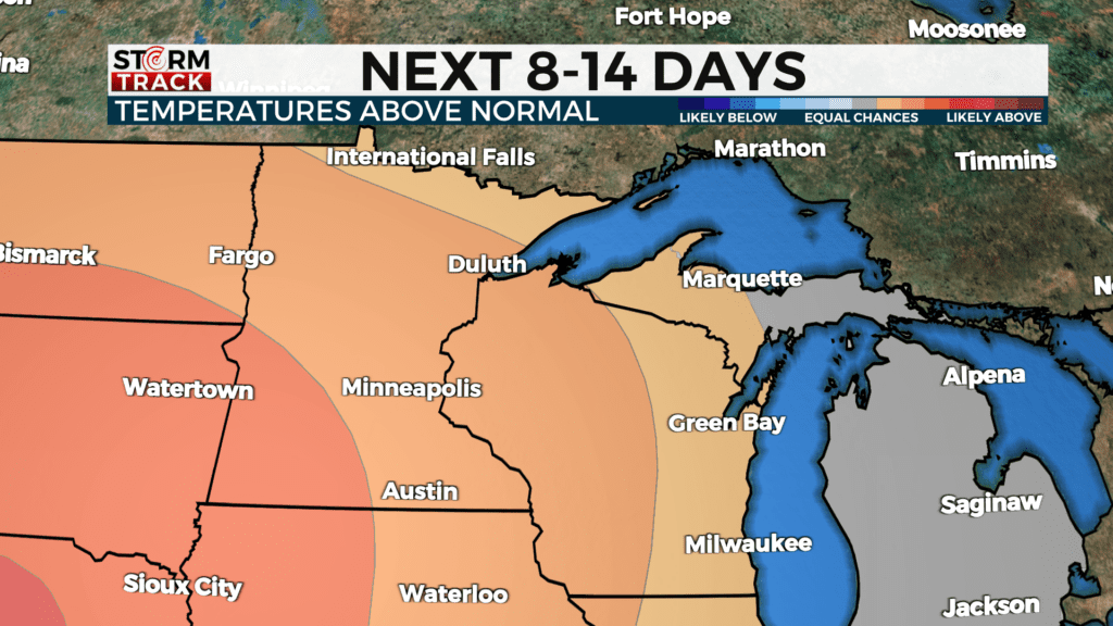
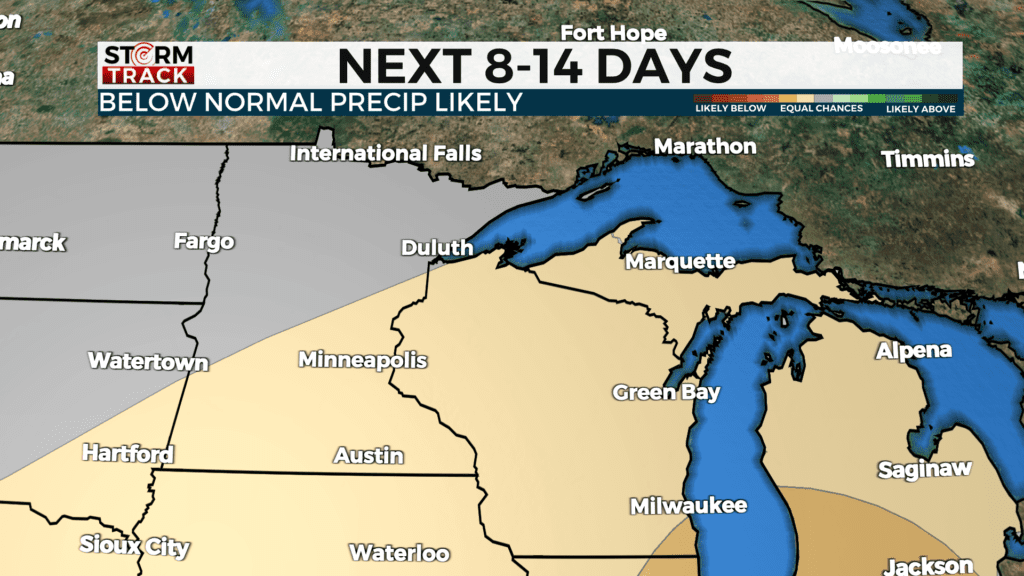
If you are looking for some good news. The next 8-14 days look warmer than average with drier conditions.
TONIGHT
Mostly cloudy, with a low around 26. West wind 5 to 10 mph becoming light northwest in the evening. Winds could gust as high as 15 mph.
FRIDAY
Mostly cloudy, with a high near 43. Calm wind becoming south around 5 mph in the morning.
SATURDAY
Sunny, with a high near 38. Breezy, with a west wind 10 to 15 mph, with gusts as high as 25 mph.
SUNDAY
Mostly sunny, with a high near 40. Breezy, with a northwest wind 10 to 15 mph, with gusts as high as 20 mph.
MONDAY
Mostly sunny, with a high near 33. Breezy, with a north wind 10 to 15 mph, with gusts as high as 20 mph.
TUESDAY
Sunny, with a high near 42. Northwest wind 5 to 10 mph, with gusts as high as 15 mph.
WEDNESDAY
Mostly sunny, with a high near 52. South wind 5 to 10 mph, with gusts as high as 15 mph.
THURSDAY
A slight chance of rain. Mostly sunny, with a high near 55. Northwest wind 5 to 10 mph, with gusts as high as 20 mph