Justin Liles: The next 48 hours looks great followed by a wintry mess through the weekend
High pressure is still in control of the weather over the next couple of days. Temperatures will likely climb into the low to mid-50s by Thursday. We are going to see plenty of sunshine during this time frame, too. We are tracking another spring storm set to impact the upper Midwest Thursday Night through Sunday. Currently, multiple precipitation types are expected with the storm. Confidence is high we will likely see everything fall from the sky. The biggest concern is the large area, including the Iron Range, Twin Ports, and Northern Wisconsin to see freezing rain and accumulating ice. Our time frame for this ice appears to be early Friday morning through noon Saturday. Amounts will determine the severity of impacts we will need to monitor, so stay tuned.
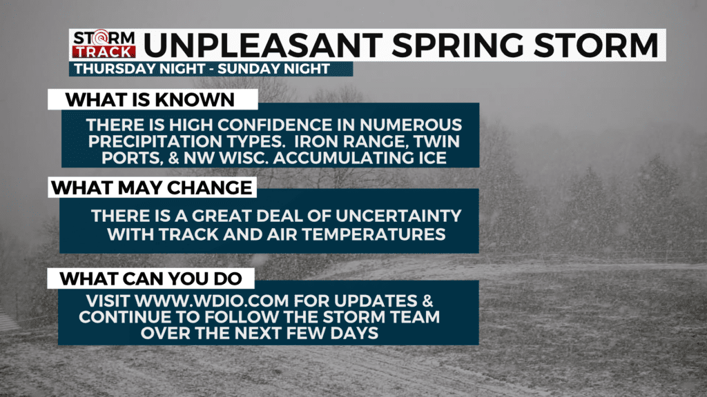
Behind this rain, there will be more snow with most of the snow falling along the higher terrain of the North Shore north of Silver Bay. Areas of northern Wisconsin near the lake will also see some accumulations. By the beginning of the work week, it looks to quiet down with plenty of sunshine.
TONIGHT
Partly cloudy, with a low around 23. North wind around 5 mph becoming calm in the evening.
WEDNESDAY
Partly sunny, with a high near 47. West wind 5 to 10 mph, with gusts as high as 20 mph.
THURSDAY
Mostly sunny, with a high near 46. Northwest wind 5 to 10 mph becoming east in the afternoon. Winds could gust as high as 15 mph.
FRIDAY
A chance of rain or freezing rain before 7 am, then rain likely. Mostly cloudy, with a high near 37. Breezy, with an east wind around 15 mph, with gusts as high as 25 mph.
FRIDAY NIGHT
Rain or freezing rain likely before 1 am, then a chance of freezing rain. Mostly cloudy, with a low around 27. Breezy, with an east wind around 15 mph, with gusts as high as 25 mph.
SATURDAY
A chance of snow and freezing rain before 1 pm, then a chance of snow and sleet. Mostly cloudy, with a high near 34. Breezy, with an east wind 15 to 20 mph, with gusts as high as 30 mph.
SATURDAY NIGHT
A chance of snow. Mostly cloudy, with a low around 23. Blustery, with a northeast wind 15 to 20 mph, with gusts as high as 30 mph.
SUNDAY
A chance of snow, mainly before 1 pm. Mostly cloudy, with a high near 36. Breezy, with a northeast wind around 15 mph, with gusts as high as 25 mph.
MONDAY
Mostly sunny, with a high near 36. Northeast wind around 10 mph, with gusts as high as 15 mph.
TUESDAY
Mostly sunny, with a high near 40. Southeast wind 5 to 10 mph, with gusts as high as 20 mph.