Justin Liles: Warm Stretch Continues
Our warm weather stretch is likely to continue this week. We may see a couple of chances of a wintry mix tonight and early tomorrow morning that could lead to slick travel early Tuesday morning. Make sure to watch Good Morning Northland to find out if you will have any issues going to school or work. Tuesday temperatures will be cooler than Monday but not by much. The entire region will again be in the upper 30s to lower 40s. There is another chance of a wintry mix Wednesday night into Thursday but once again it will likely do more harm to our snowpack then good.
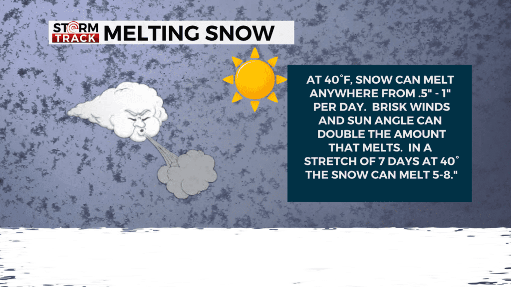
As the unseasonably warm weather stretch continues, we will see temperatures cool down some Saturday and Sunday, however it will still be near 30°F. The entire region returns to the 40s. This warm trend could have major impacts on local ski hills, trails, and events. Warm conditions along with winds can increase melting rates around the region.
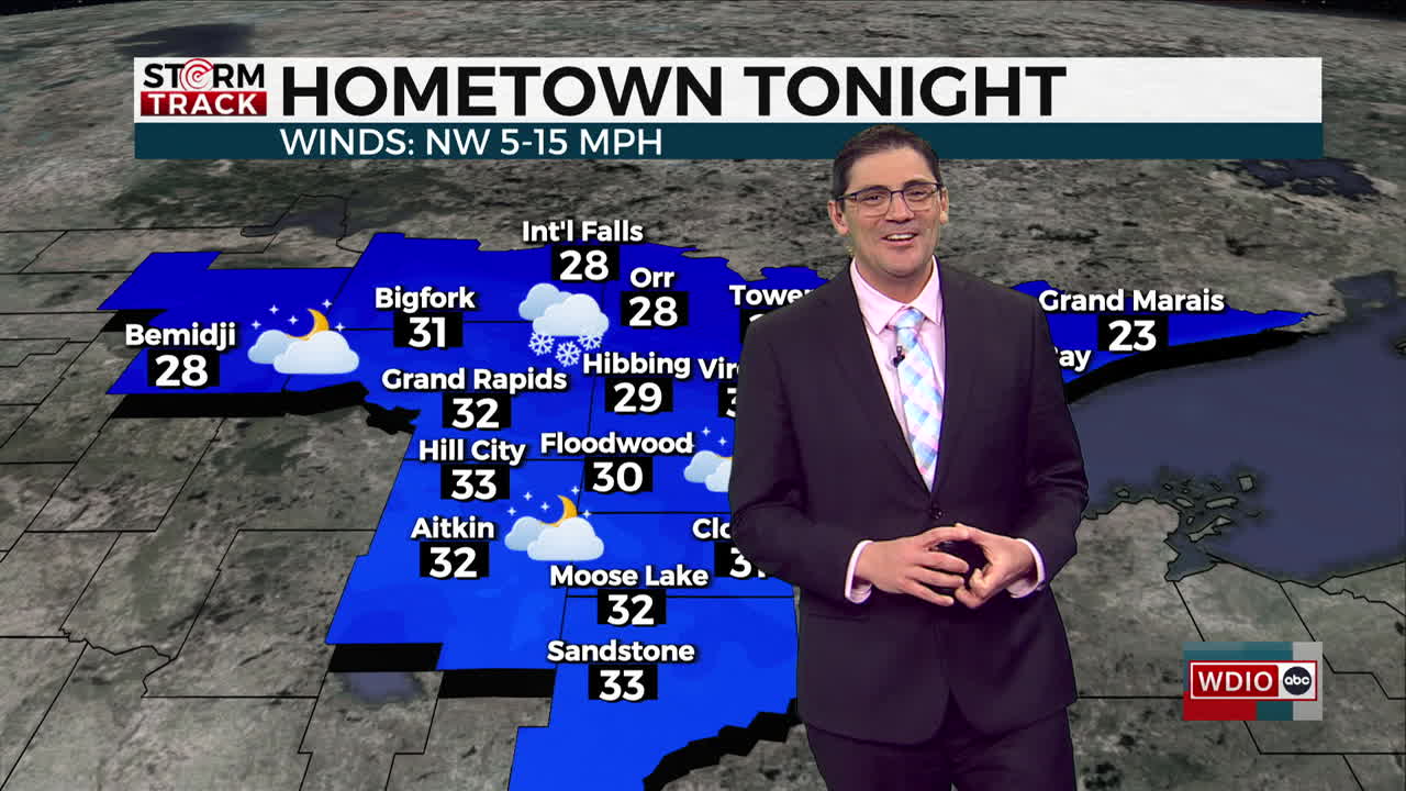
TONIGHT
A chance of a wintry mix late, mostly cloudy, with a low around 27. Northwest wind 5 to 10 mph, with gusts as high as 20 mph.
TUESDAY
A chance of early am flurries, partly sunny, with a high near 38. West wind around 5 mph becoming south in the afternoon.
WEDNESDAY
A 20 percent chance of snow before noon. Mostly cloudy, with a high near 40. North wind 5 to 10 mph becoming northwest in the afternoon. Winds could gust as high as 15 mph.
THURSDAY
Mostly cloudy, with a high near 35. Breezy, with a northwest wind 5 to 15 mph, with gusts as high as 20 mph.
FRIDAY
A chance of rain and snow. Mostly cloudy, with a high near 37. Breezy, with a southeast wind around 15 mph becoming northwest in the afternoon. Winds could gust as high as 30 mph.
SATURDAY
Partly sunny, with a high near 27. Northwest wind around 10 mph, with gusts as high as 20 mph.
SUNDAY
Mostly sunny, with a high near 33. South wind 5 to 10 mph, with gusts as high as 15 mph.
MONDAY
A slight chance of rain. Mostly sunny, with a high near 44. Southwest wind around 10 mph, with gusts as high as 20 mph.