Justin Liles: Wintry mix possible over the next few days
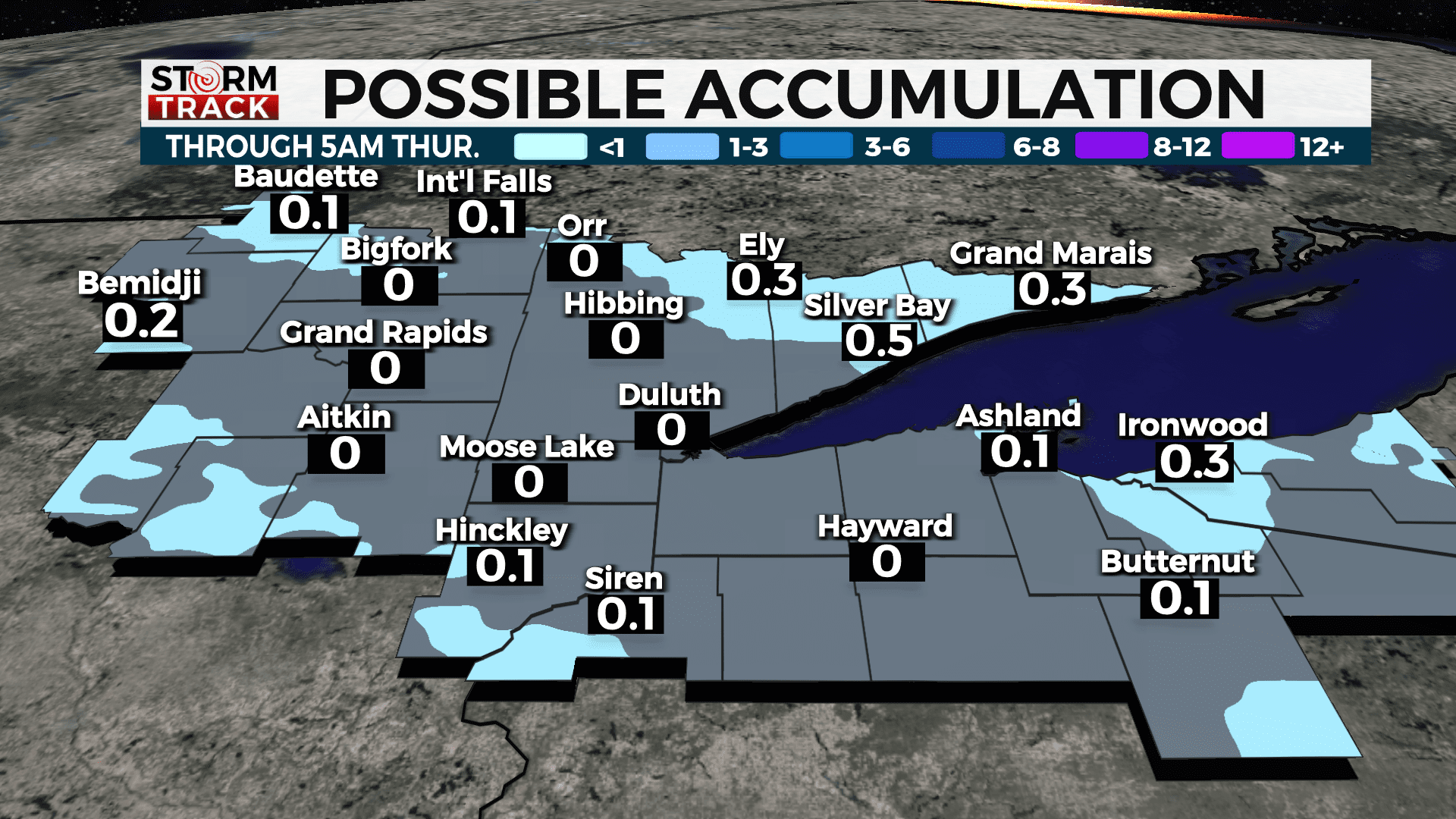
Tonight, there is a chance for a light wintry mix, mainly from the Brainerd Lakes into northwest Wisconsin. A light glaze of ice may be possible, especially for parts of northwest Wisconsin. There could be some slick spots once again Wednesday morning. There could be a few slick spots come Wednesday morning. Total accumulations of rain, ice, and snow are expected to be minimal. A little snow will fall through early Thursday.

The best chance for some accumulating snow is possible late Thursday night into Friday, with the best chances in the Arrowhead and along the Canadian Border where chance for seeing 2″ of snow or more with heavier amounts in Canada. This is great news with the Beargrease starting this weekend.
TONIGHT
A wintry mix overnight and the potential for patchy fog after 3am. Otherwise, mostly cloudy, with a low around 30. South wind around 5 mph becoming north after midnight.
WEDNESDAY
A chance of flurries before 8am. Patchy fog before noon. Otherwise, mostly cloudy, with a high near 40. Northwest wind 5 to 10 mph.
THURSDAY
Partly sunny, with a high near 36. Breezy, with a northwest wind 10 to 20 mph, with gusts as high as 25 mph.
FRIDAY
A 40 percent chance of snow. Mostly cloudy, with a high near 39. Breezy, with a south wind 15 to 20 mph becoming northwest in the afternoon. Winds could gust as high as 35 mph.
SATURDAY
Sunny, with a high near 24. Blustery, with a north wind 5 to 15 mph, with gusts as high as 20 mph.
SUNDAY
Mostly sunny, with a high near 32. Southwest wind 5 to 10 mph, with gusts as high as 15 mph.
MONDAY
Partly sunny, with a high near 44. Breezy, with a southwest wind 10 to 15 mph, with gusts as high as 20 mph.
TUESDAY
A chance of rain and snow. Mostly cloudy, with a high near 41. Northwest wind around 10 mph, with gusts as high as 20 mph.