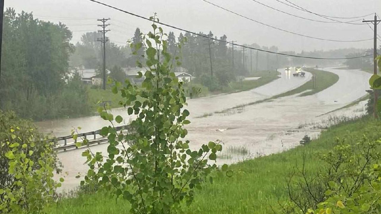
Rainfall Amounts: Heavy rains cause flash flooding

Highway 169 near Hibbing. Nina Pleshe
Overnight on Monday and continuing Tuesday, storms moved across the Northland bringing lots of lightning, strong winds and heavy rain. Flash flooding is happening across northeast Minnesota including the Iron Range this evening. According to the National Weather Service, the most intense flash flooding is from Cook to Tower and north, including Lake Vermilion. There are reports of 4-6 inches that have fallen so far.
Authorities ask the public to not attempt to travel unless fleeing an area that is flooding. Turn around, do not drive through flooded roadways, especially as it gets later in the evening.
The Storm Track Weather team is tracking additional rainfall for the evening. There have been multiple warnings issued, including Tornado Warnings in northern and Central St. Louis County. An tornado was spotted on the ground near Cotton, along Comstock Lake Road, law enforcement confirmed.
We are under a Flash Flood Warning for Cass, Itasca, southern portion of Koochiching, and northern St. Louis and Lake Counties until 11pm Tuesday night. Flash floods have been reported for East Pattison Road in Ely at 5:25 pm and 1 S Hibbing at 5:16 p.m. Chisholm also has reports of Flash Flooding. Remember not to drive through flood waters.
Flash flooding reported near Tower, Highway 1 between Tower and Cook has areas with water across the road, and one area has one lane of traffic. Highway 22 also has water flowing across it, with deep water. MnDOT reports flooding on Minnesota Highway 73 between Forest Road 282 and Osborn Road in St. Louis County. Stay safe.
A Flood Watch remains in effect until Wendesday morning for Koochiching, North and Central St. Louis, Itasca and North Cass counties in Minnesota and most of Minnesota is under a Tornado Watch until 8pm.
Heavy rain and excessive runoff could lead to flooding along rivers and creeks, as well as ditches and low-lying areas. Some areas in the Watch zone could receive an additional 1-3 inches of rain on top of what has already fallen over saturated ground.
Track the Watches and Warnings posted for Minnesota, Wisconsin and U.P. of Michigan
Follow the storms with the Interactive Radar.
Get your latest forecast information here.
Official rainfall amounts reported to the National Weather Service as of 5:30 p.m. on Tuesday, June 18.
A funnel cloud was reported near 15 N Robinson in St. Louis County. According to the report, the funnel cloud could be seen looking NW from Moose Lake in the BWCA at 3:25 PM.
- 5:29 PM – 1 E Iron Junction – 5.00 inches – St. Louis County
- 5:01 PM – 3 S Cohasset – 3.91 inches – Itasca County
- 5:10 PM – 1 NW Chisholm – 3.82 inches – St. Louis County
- 7:30 AM – 8 W Pine Center – 2.40 inches – Crow Wing County
- 7:00 AM – 1 W Pelland – 1.91 inches – Koochiching County
- 7:00 AM – 2 S Tamarack – 1.91 inches – Aitkin County
- 8:30 AM – 1 SSW Breezy Point – 1.85 inches – Crow Wing County
- 7:00 AM – 4 SSE Garrison – 1.76 inches – Aitkin County
- 8:00 AM – 1 NNW Big Falls – 1.59 inches – Koochiching County
- 7:30 AM – 1 NW international Falls – 1.51 inches – Koochiching County
- 8:00 AM – 3 E Ranier – 1.46 inches – Koochiching County
- 8:30 AM – Lake Shore – 1.43 inches – Cass County
- 6:00 AM – 3 ENE Wright – 1.33 inches – Carlton County
- 6:00 AM – 2 SW Tamarack – 1.28 inches – Aitkin County
- 9:00 PM 6/17 – Butternut – 1.20 inches – Ashland County
- 8:10 AM – 8 ESE Northome – 1.18 inches – Itasca County
- 7:00 AM – 7 SE Siren – 1.15 inches – Burnett County
- 6:00 AM – 3 ESE Sarona – 1.13 inches – Washburn County
Some road washouts are being reported in multiple counties in Minnesota. There was also a report of a birch tree that snapped 10 feet above the ground near Grand Rapids in Itasca County. The National Weather Service says it is likely that this occurred with the first storm around 3:30 AM.
The WDIO Storm Track team is watching conditions and will update the list as additional reports come in. Again, more heavy rain is possible Tuesday evening. Watch WDIO and WDIO.com for weather updates.


