Lea Zmurko: Still more snow in store
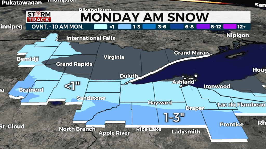
Snow stays south of the Twin Ports this morning as a narrow band of moderate snow across from Brainerd lakes out to the UP. Light snow may migrate further north, but most of the accumulation will stay in that corridor. All the snow should wrap up by the early afternoon and cloud coverage will continue to be consistent
Temperatures stay near normal all week with highs in the teens and overnight lows dipping below zero. As skies start to clear late tonight, temperatures will be chilly by tomorrow morning with some wind chill values elevated further north across the Borderlands and the Arrowhead. This could initiate some lake effect snow for the South Shore as the cold air cuts across Lake Superior
The next serious set-up for some snow will arrive on Wednesday night and continue into Thursday morning, with a highly likely potential for several inches of accumulation. As this clipper nears, details on timing and amount of snowfall will start to align.
Today
A chance of snow before 9am, then a chance of flurries between 9am and 11am. Mostly cloudy, with a high near 17. Northwest wind around 10 mph, with gusts as high as 20 mph. Chance of precipitation is 30%.
Tonight
Partly cloudy, with a low around -8. Blustery, with a northwest wind 10 to 15 mph, with gusts as high as 25 mph.
Tuesday
A chance of flurries after noon. Partly sunny, with a high near 11. Northwest wind 5 to 10 mph.
Wednesday
Snow likely after noon. Mostly cloudy, with a high near 19. East wind 5 to 10 mph. Chance of precipitation is 60%. New snow accumulation of less than one inch possible.
Thursday
Partly sunny, with a high near 15. Breezy, with a west wind 15 to 20 mph, with gusts as high as 30 mph.
Friday
Mostly sunny, with a high near 18. West wind 5 to 10 mph, with gusts as high as 15 mph.
Saturday
A chance of snow. Mostly cloudy, with a high near 22. North wind 5 to 10 mph.
Sunday
Mostly sunny, with a high near 19. West wind 5 to 10 mph, with gusts as high as 15 mph.