Justin Liles: Another cold night
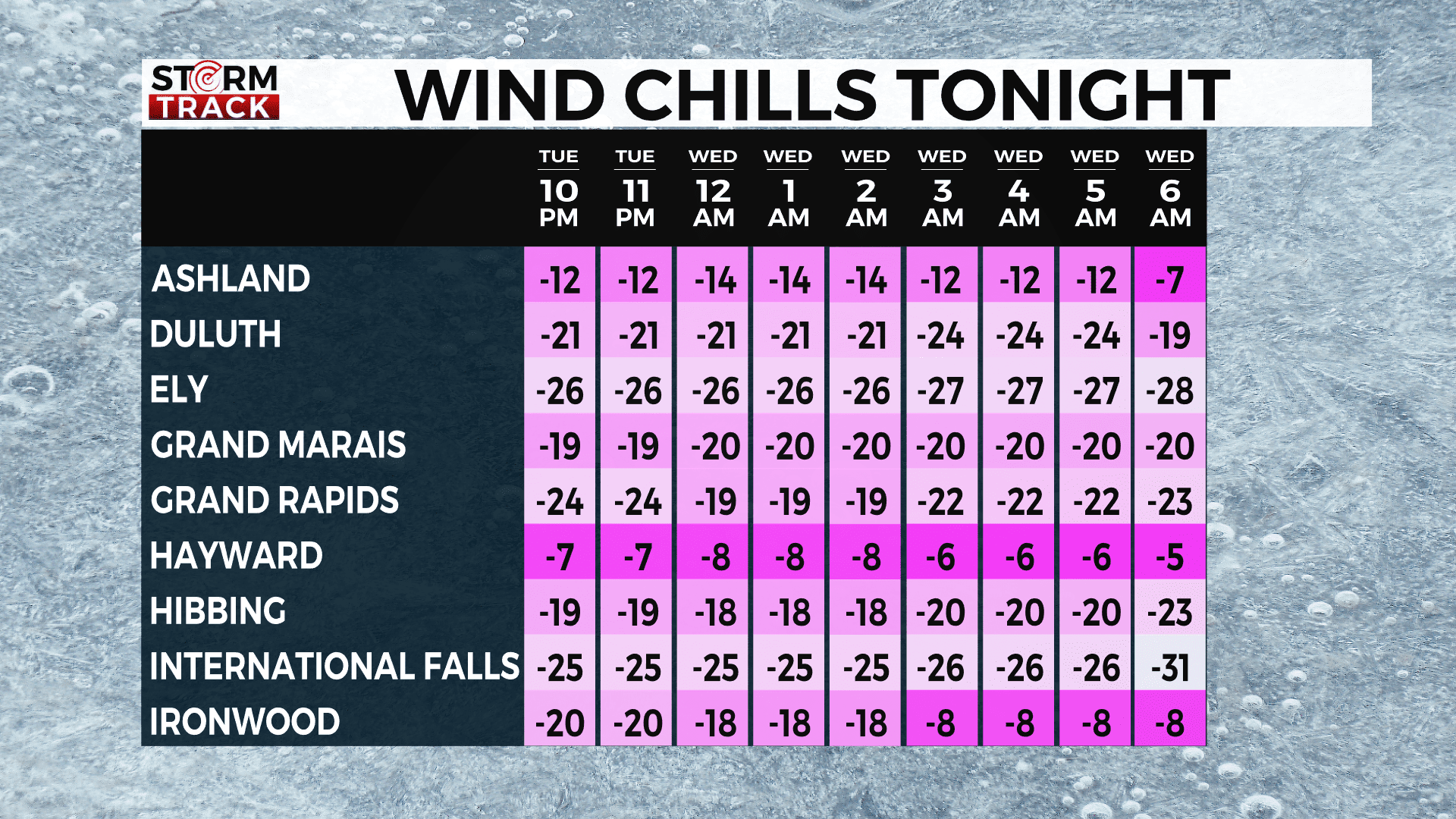
Temperatures this morning hard to bear. Nearly all the Northland saw temperatures somewhere between -10° and -30°. These were just the temperature readings with out the wind. You factor in the winds, and it was much colder. We did get to see plenty of sunshine as the along with rebounding temperatures. Now winds will continue to weaken overnight. There are still parts of the Northland looking to see wind chills -20° to -40°. These areas will be the Northern part of our viewing area. A Cold Weather Advisory has been issued for these regions until 10am Wednesday.

Colder air will become modified some by the end of the week when a chance of snow returns. At the moment the snow looks to come Friday and could drop as much as 1-2”. Colder weather looks to stick around through the weekend.
Tonight
Partly cloudy, with a low around -17. Wind chill values between -20 and -25. West wind around 5 mph.
Wednesday
Partly sunny, with a high near 10. Calm wind becoming west around 5 mph in the afternoon.
Thursday
Sunny, with a high near 6. Wind chill values between -15 and -25. Northwest wind 5 to 10 mph, with gusts as high as 15 mph.
Friday
Snow likely after noon. Mostly cloudy, with a high near 16. South wind 5 to 10 mph becoming east in the afternoon. Chance of precipitation is 60%. New snow accumulation of 1 to 2 inches possible.
Saturday
Mostly sunny, with a high near 12. North wind around 10 mph, with gusts as high as 20 mph.
Sunday
Mostly sunny and cold, with a high near 5. Northwest wind 5 to 10 mph, with gusts as high as 15 mph.
Washington’s Birthday
Mostly sunny, with a high near 6. West wind 5 to 10 mph, with gusts as high as 15 mph.
Tuesday
Mostly sunny, with a high near 10. Northwest wind 5 to 10 mph, with gusts as high as 20 mph.