Justin Liles: Breezy & warm Wednesday
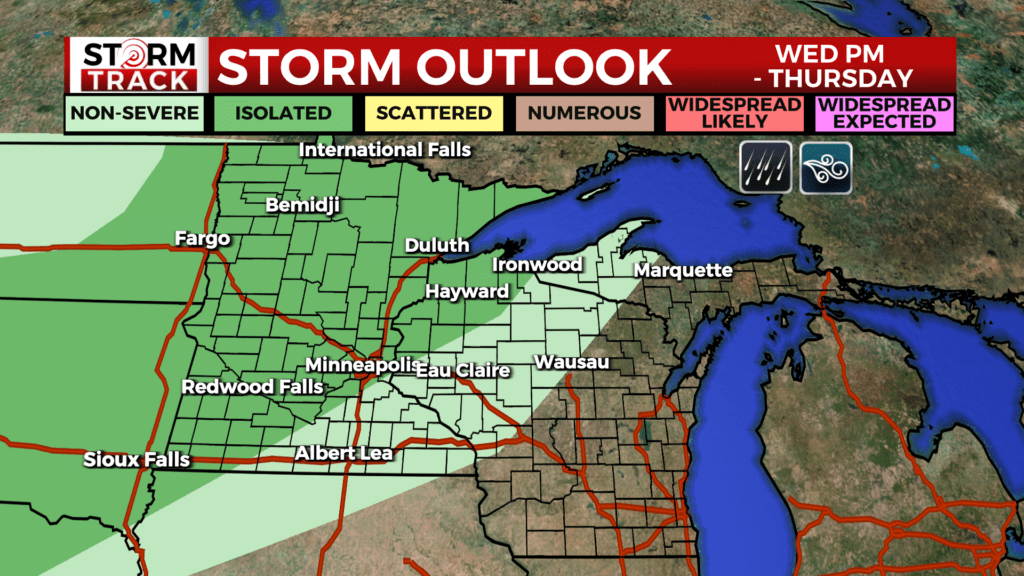
The first day back to school was ideal in the weather department. It might have been a touch windy at times but at least the skies were blue, and the temperatures were warm. Tomorrow breezy winds will continue but there will be an increase in temperatures and humidity. There is a chance of some scattered showers, and a few thunderstorms Wednesday through Friday. There is a higher risk of strong to severe storms Wednesday afternoon through Wednesday night and into Thursday morning with passing of a cold front.
Temperatures trend cooler for Thursday and Friday. Areas of frost are possible Friday night and early Saturday morning and again Saturday night into Sunday morning with lows dipping into the 30s. The most likely areas will be across the Iron Range, International Border, and Arrowhead. This weekend will be much cooler than average with highs in the upper 50s to lower 60s on Saturday. A warming trend returns by next Monday.
TONIGHT
Mostly clear, with a low around 56. Breezy, with a southwest wind 10 to 15 mph, with gusts as high as 30 mph.
WEDNESDAY
Mostly sunny, with a high near 78. Breezy, with a southwest wind 10 to 15 mph, with gusts as high as 30 mph.
THURSDAY
Early morning thunderstorms, Partly sunny, with a high near 71. Northwest wind 5 to 10 mph, with gusts as high as 20 mph.
FRIDAY
A slight chance of showers. Partly sunny, with a high near 58. North wind 5 to 10 mph, with gusts as high as 15 mph.
SATURDAY
Mostly sunny, with a high near 59. North wind around 5 mph.
SUNDAY
Mostly sunny, with a high near 64. West wind 5 to 10 mph, with gusts as high as 15 mph.
MONDAY
Sunny, with a high near 69. West wind 5 to 10 mph becoming south in the afternoon.