Justin Liles: Chance of storms tonight
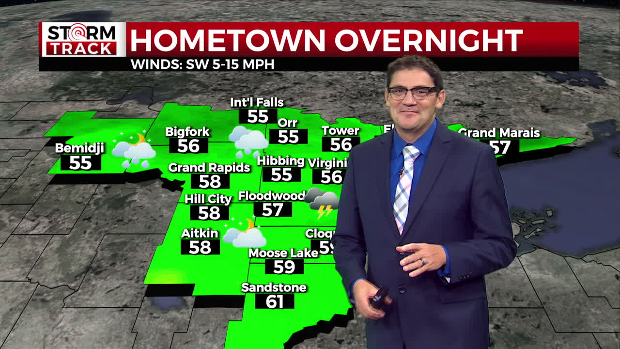
A cold front will move through the Northland from northwest to southeast. Some of these storms could be possibly bring some severe weather late tonight. The biggest threat looks to be hail and winds. The best time frame for these storms will be between the hours of 9pm and 6am.
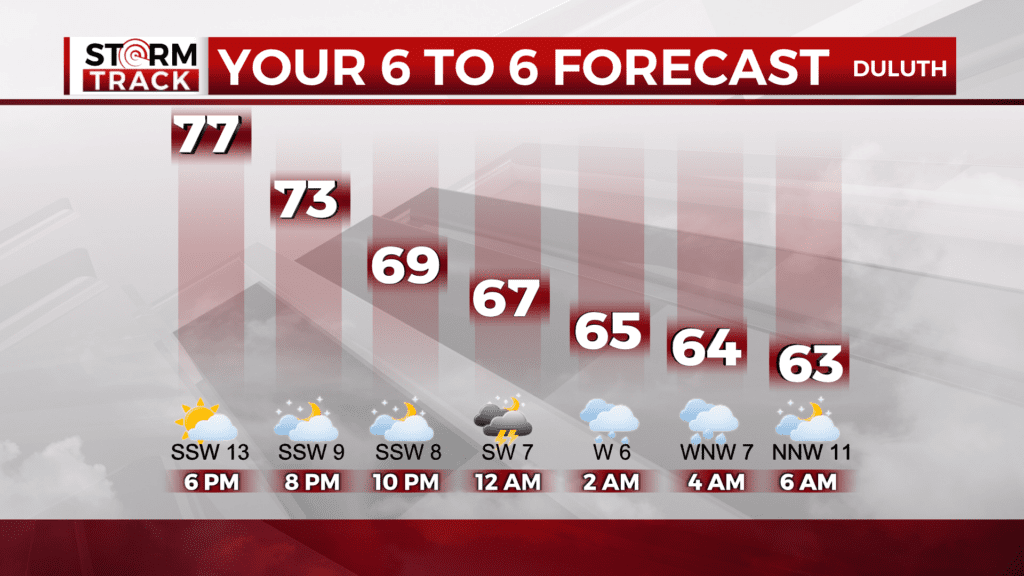
Rain will linger and become sporadic through the day Thursday. The emergence of afternoon sunshine could be enough to help squeeze out some additions rain late Thursday into Friday.
Beginning Friday, the temperatures will take a bid of a dip for highs and low through at least the first half of the weekend. If heading out Friday evening to watch your favorite high school football team you may want to think about bringing a blanket, heavier jacket, hats and gloves. Highs on Friday will likely be in the upper 50s to lower 60s. It will likely be warmer by the lake due to easterly winds and Lake Superior being in the 60s. Overnight lows away from the lake has a great chance of seeing some frost Saturday morning and Sunday morning as temperatures drop into the 30s More sun and warmer weather returns next week.
TONIGHT
Showers and thunderstorms likely. Mostly cloudy, with a low around 58. South wind 5 to 10 mph becoming northwest after midnight. Winds could gust as high as 20 mph.
THURSDAY
A chance of showers and thunderstorms before 10am, then a slight chance of showers after noon. Cloudy, then gradually becoming mostly sunny, with a high near 69. Breezy, with a northwest wind 10 to 15 mph, with gusts as high as 20 mph.
FRIDAY
A 20 percent chance of showers before 1pm. Mostly sunny, with a high near 62. North wind 5 to 10 mph, with gusts as high as 15 mph.
SATURDAY
Sunny, with a high near 64. Calm wind becoming northwest around 5 mph in the morning.
SUNDAY
Sunny, with a high near 72. West wind 5 to 10 mph, with gusts as high as 15 mph.
MONDAY
Sunny, with a high near 76. Southwest wind around 5 mph.
TUESDAY
Mostly sunny, with a high near 74. Southeast wind 5 to 10 mph.