Justin Liles: Dry conditons to increase the fire risk in the Northland
Warm and dry conditions will continue over the next 7-10 days. Our abnormally dry weather will likely worsen our current drought and cause fire concerns to worsen. Winds will be rather gusty over the next 7 days. Red flag warnings may be a daily thing in the weather department. Check for any burning restrictions in your area before having a fire. There remains little potential for appreciable precipitation
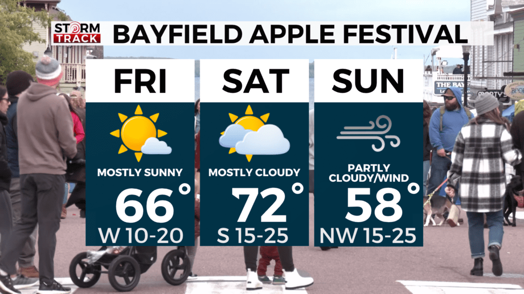
over the next 7 days. Temperatures will gradually cool down behind a cold front that will slide through tonight. High pressure will move in and lock the cooler air in place. Widespread frost is likely Thursday night into Friday morning. A Frost Advisory is possible during this time. If planning on hitting the Bayfield Apple Festival this weekend here is a look at what you can expect.
TONIGHT
Mostly clear, with a low around 43. Breezy, with a west wind 5 to 15 mph, with gusts as high as 25 mph.
THURSDAY
Sunny, with a high near 60. Breezy, with a west wind 5 to 15 mph, with gusts as high as 20 mph.
FRIDAY
Areas of frost before 8am. Otherwise, sunny, with a high near 65. West wind 5 to 10 mph, with gusts as high as 20 mph.
SATURDAY
A 20 percent chance of showers and thunderstorms after 1pm. Mostly sunny, with a high near 72. Breezy, with a south wind 15 to 20 mph, with gusts as high as 30 mph.
SUNDAY
Mostly sunny, with a high near 59. Breezy, with a northwest wind around 20 mph, with gusts as high as 30 mph.
MONDAY
Sunny, with a high near 62. Northwest wind 5 to 10 mph, with gusts as high as 20 mph.
TUESDAY
Sunny, with a high near 66. Southwest wind 5 to 10 mph, with gusts as high as 15 mph.
WEDNESDAY
Sunny, with a high near 69. South wind 5 to 10 mph, with gusts as high as 15 mph.