Justin Liles: Fire danger to increase over the next few days
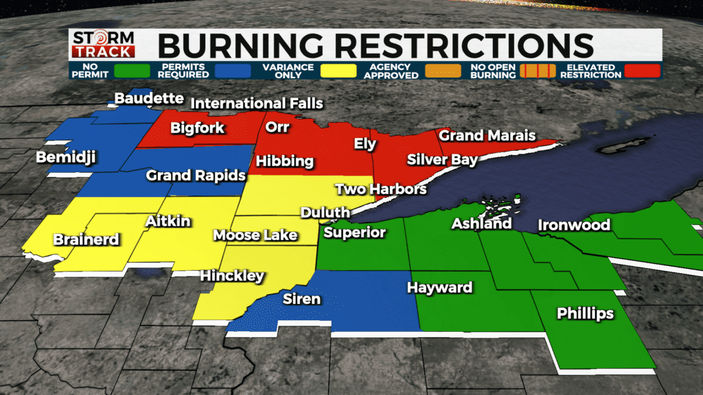
The biggest weather story the rest of the week will be the increasing temperatures, low humidity, and increasing winds. These conditions will likely increase the fire danger around the Northland. Wednesday afternoon and Thursday afternoon are time frames of concern for fire danger due to windy conditions and warmer temperatures. Current burning restrictions a in place for some parts of the Northland.
We will be seeing plenty of sunshine through the rest of the week. The best chance of seeing some rain won’t arrive until Friday afternoon and Saturday. We won’t have enough rain to put a dent in our current moisture deficit. Current trends look to keep this warmer air around for the next 7-10 days. Temperatures in the next week are expected to be 10°-20°F above average. The fall colors are nearly peak across the entire region.
TONIGHT
Mostly clear, with a low around 27. Northwest wind around 5 mph becoming calm.
WEDNESDAY
Sunny, with a high near 57. Breezy, with a southwest wind 5 to 15 mph, with gusts as high as 25 mph.
THURSDAY
Sunny, with a high near 63. Breezy, with a south wind around 15 mph, with gusts as high as 30 mph.
FRIDAY
Mostly sunny, with a high near 67. Breezy, with a south wind around 15 mph, with gusts as high as 25 mph.
SATURDAY
A chance of showers. Mostly cloudy, with a high near 60. South wind 5 to 10 mph.
SUNDAY
Mostly sunny, with a high near 66. Southwest wind 5 to 10 mph, with gusts as high as 20 mph.
MONDAY
Partly sunny, with a high near 69. Breezy, with a south wind 10 to 15 mph, with gusts as high as 20 mph.