Justin Liles: Quiet before showers tomorrow night
Our weather will remain on the quiet side until Thursday afternoon and evening. This should carry over into Friday morning when some widespread fog is possible. A few strong thunderstorms are possible in north-central Minnesota Thursday evening, but severe weather is not expected. There could be some locally heavy rain that could fall across the Arrowhead of Minnesota.
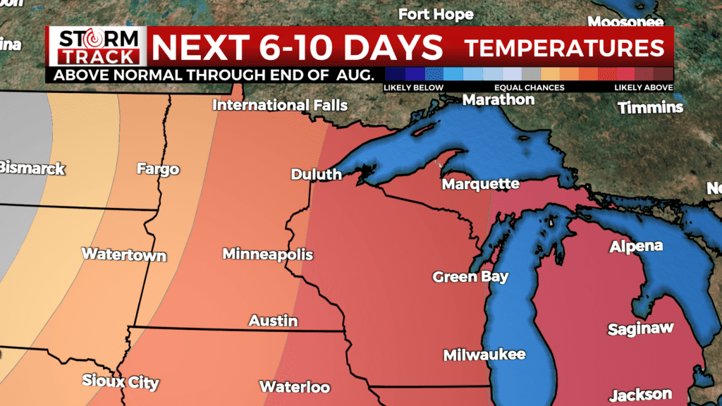
Seasonable temperatures continue to end this work week. Temperatures and dewpoints rise into this weekend, with muggy conditions expected. Some mid 80s are possible farther inland away from the lake. A light breeze off Lake Superior this weekend could keep the shoreline communities more comfortable. Mild weather looks to continue into next week and there is still a chance for some thunderstorms late Monday into Thursday. Current outlooks show a 50-70% chance of above normal temperatures through the end of the month, returning to near normal in early September.
TONIGHT
Mostly clear, with a low around 53. East wind around 5 mph.
THURSDAY
A 10 percent chance of showers after 5pm. Increasing clouds, with a high near 75. Breezy, with a south wind 5 to 15 mph, with gusts as high as 20 mph.
THURSDAY NIGHT
A chance of showers and thunderstorms, mostly cloudy, with a low around 60. South wind around 10 mph, with gusts as high as 20 mph.
FRIDAY
Partly sunny, with a high near 78. Southwest wind around 10 mph, with gusts as high as 15 mph.
SATURDAY
Mostly sunny, with a high near 82. Calm wind becoming southeast around 5 mph in the morning.
SUNDAY
Mostly sunny, with a high near 80. East wind 5 to 10 mph, with gusts as high as 15 mph.
MONDAY
Mostly sunny, with a high near 81. Northeast wind 5 to 10 mph becoming west in the afternoon. Winds could gust as high as 15 mph.
TUESDAY
Sunny, with a high near 79. Southwest wind around 10 mph, with gusts as high as 20 mph.