Justin Liles: Spotty showers tonight followed by chilly weather
A cold front has swept through the Northland, and we are still seeing some of the residuals of the showers we had overnight. We have had periods of sunshine to help generate some additional afternoon showers. Light sprinkles are possible tonight into Friday morning as cooler than average temperatures take over Friday and Saturday. Friday night football games are going to be a bit on the chilly side so you may want to think about wearing an extra layer. A hat and gloves might be possible too.
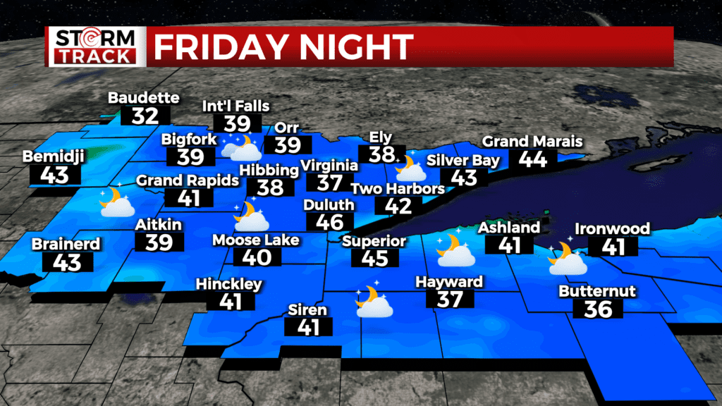
Friday night into Saturday we may see our first frost of the season north of the Twin Ports across the Iron Range and up to the International Border as lows drop into the 30s. Some of those cooler spots like Hibbing and Tower may drop closer to 32°.
The good news is we will see plenty of sunshine this weekend. Temperatures will be cooler than average on Saturday and then warm up with drier conditions next week.
TONIGHT
A 20 percent chance of showers and thunderstorms. Partly cloudy, with a low around 45. North wind around 5 mph.
FRIDAY
A slight chance of showers between 8am and 11am. Mostly sunny, with a high near 61. Northeast wind 5 to 10 mph, with gusts as high as 15 mph.
SATURDAY
Sunny, with a high near 65. Calm wind becoming west around 5 mph in the afternoon.
SUNDAY
Sunny, with a high near 76. West wind 5 to 10 mph, with gusts as high as 20 mph.
MONDAY
Sunny, with a high near 79. South wind around 5 mph.
TUESDAY
Partly sunny, with a high near 76. Southeast wind 5 to 10 mph, with gusts as high as 15 mph.
WEDNESDAY
Mostly sunny, with a high near 79. South wind 5 to 10 mph, with gusts as high as 15 mph.
THURSDAY
Sunny, with a high near 80. South wind 5 to 10 mph, with gusts as high as 20 mph.