Lea Zmurko: A messy Monday morning
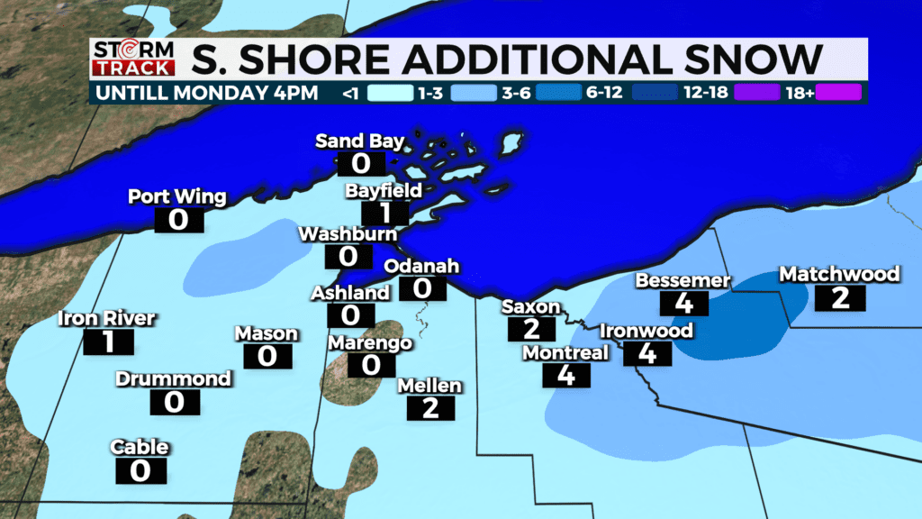
The winter system from this weekend finally exits mid-day but some lake effect snow lingers for the South Shore. Another few inches of snow can be expected as the northwest winds remain favorable through the late afternoon. Winter weather headlines remain in place for many as conditions could continue to bring messy roads and additional snowfall across the Arrowhead and northern Wisconsin.
The rest of the week remains relatively dry, but there is a chance for a few scattered spots of light mixed precipitation in the coming days, however nothing measurable until the weekend.
Today
A chance of flurries before 8am. Mostly cloudy, then gradually becoming sunny, with a high near 39. Breezy, with a northwest wind around 15 mph, with gusts as high as 30 mph.
Tonight
Mostly clear, with a low around 19. North wind around 5 mph.
Tuesday
Mostly sunny, with a high near 43. Northwest wind around 5 mph.
Wednesday
Mostly sunny, with a high near 46. West wind 5 to 10 mph, with gusts as high as 20 mph.
Thursday
Mostly sunny, with a high near 47. Northwest wind 5 to 10 mph becoming east in the afternoon.
Friday
A chance of rain and snow. Mostly cloudy, with a high near 37. Breezy, with an east wind 15 to 20 mph, with gusts as high as 30 mph.
Saturday
Rain, snow, and freezing rain likely. Mostly cloudy, with a high near 37. Breezy, with a northeast wind 15 to 20 mph, with gusts as high as 30 mph.
Sunday
A chance of snow. Mostly cloudy, with a high near 36. Breezy, with a northeast wind 15 to 20 mph, with gusts as high as 25 mph.