Lea Zmurko: Dense fog, thick humidity, and some isolated thunderstorms
All morning long there will be low lying clouds across Northern Wisconsin and the Iron Range. There is a dense fog advisory in place until 9 AM for all northern Wisconsin counties except for Burnett. The fog will inhibit visibility across these areas, so use extra caution on morning commutes. However, we can expect conditions to clear as the sun continues to rise and burn off the clouds with daytime heating.
Conditions will remain hot and humid through the afternoon hours. The southerly wind is encouraging these higher temperatures. Highs for today will be on the 80s to low 90s across the Northland, dewpoints will also be staying well above 60 degrees throughout today and tomorrow keeping the climate muggy, sticky, and uncomfortable.
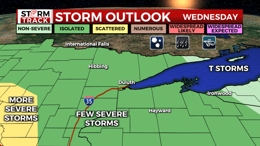
Later this afternoon and through the overnight hours there is a chance for strong to severe thunderstorms passing across north-central Minnesota and up into the Arrowhead. The elevated risks remain for damaging winds, large hail, and heavy rain.
There is an additional chance for some scattered showers and storms tomorrow across northern Wisconsin, temperatures will fall slightly for a brief break from the heat on Thursday. However, hot temperatures return by Friday with hot and dry conditions moving in for the weekend.
Today
A 20 percent chance of showers and thunderstorms after 4pm. Patchy fog before 8am. Otherwise, mostly sunny, with a high near 87. Light southeast wind becoming south 5 to 10 mph in the morning.
Tonight
A 40 percent chance of showers and thunderstorms, mainly after 8pm. Mostly cloudy, with a low around 66. Southeast wind around 5 mph becoming west after midnight.
Thursday
A 40 percent chance of showers and thunderstorms. Partly sunny, with a high near 82. North wind 5 to 10 mph.
Friday
Sunny and hot, with a high near 90. Northwest wind around 5 mph.
Saturday
Mostly sunny, with a high near 84. Northwest wind around 5 mph.
Sunday
A slight chance of showers before 1pm. Mostly sunny, with a high near 77. Northeast wind 5 to 10 mph.
Monday
A chance of showers. Partly sunny, with a high near 74. East wind 5 to 10 mph.
Tuesday
A slight chance of showers and thunderstorms. Partly sunny, with a high near 75. Northeast wind 5 to 10 mph becoming northwest in the afternoon. Winds could gust as high as 15 mph.