Lea Zmurko: No break from the cold this week
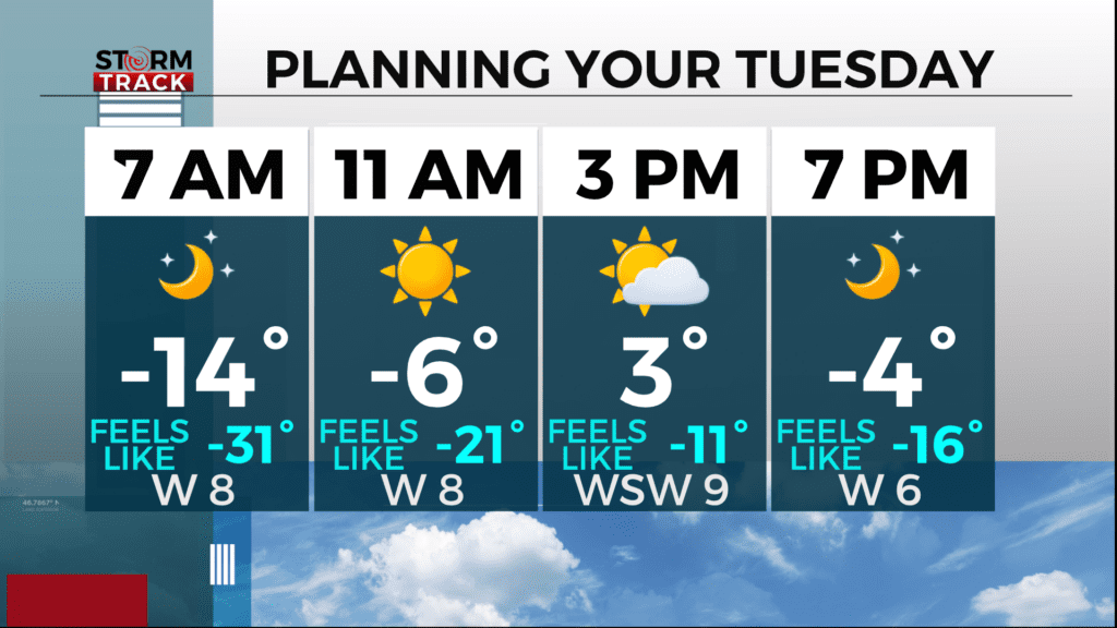
We start off Tuesday with brisk air and drastic windchills. A Cold Weather Advisory is in place this morning for most of the region as the conditions outside feels like -25 to -35 until the afternoon when winds die down and the sunshine helps assist conditions to get out of the advisory threshold.
With high pressure overhead and cloud coverage remaining sparce, temperatures will likely drop well below zero tonight and another cold weather alert may be issued for the early hours on Wednesday morning. The Northland is staying in a very chilly trend for the next week as temperatures remain mostly 15 to 20 degrees below normal.
The clear skies also mitigate the chances for snow for the next few days, but a clipper is expected to move into the region by Friday afternoon bringing measurable snow south of the Iron Range and across northern Wisconsin
Today
Sunny and cold, with a high near 2. Wind chill values between -25 and -35. Northwest wind 5 to 10 mph.
Tonight
Partly cloudy, with a low around -20. Wind chill values between -25 and -30. West wind around 5 mph becoming calm after midnight.
Wednesday
Partly sunny, with a high near 9. Calm wind becoming west around 5 mph.
Thursday
Sunny, with a high near 7. Northwest wind 5 to 10 mph becoming west in the afternoon. Winds could gust as high as 15 mph.
Friday
A chance of snow after noon. Mostly cloudy, with a high near 17. Southwest wind 5 to 10 mph becoming east in the afternoon.
Saturday
Partly sunny, with a high near 14. Blustery, with a north wind 10 to 15 mph, with gusts as high as 20 mph.
Sunday
Mostly sunny, with a high near 6. Northwest wind around 10 mph, with gusts as high as 20 mph.
Monday
Mostly sunny, with a high near 6. Northwest wind 5 to 10 mph, with gusts as high as 15 mph.