Lea Zmurko: Sun is shining till the end
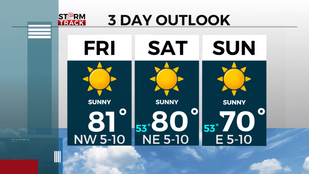
Wrapping up the week with seasonal temperatures as highs reach those low 80s today and tomorrow. These elevated temperatures are near record breaking highs in some areas across the Northland for the end of September. Clear skies persist overhead as high pressure continues to move across the Midwest with a light wind.
The early morning hours had some patchy fog that cleared with the sunrise. Winds will pick up speed by the afternoon shifting to the northwest as the day brightens.
There will be a change in weather patterns by Monday afternoon as a cold front crosses bringing in a cooler air mass for the first week of October. With the cooler air, also comes a greater chance for frost in the early mornings next week. Slight chance for some showers late on Monday north of the Iron Range.
Today
Sunny, with a high near 82. West wind around 5 mph becoming northwest in the afternoon.
Tonight
Clear, with a low around 53. North wind around 5 mph.
Saturday
Sunny, with a high near 80. North wind around 5 mph becoming east in the afternoon.
Sunday
Sunny, with a high near 70. East wind 5 to 10 mph, with gusts as high as 15 mph.
Monday
Mostly sunny, with a high near 77. Breezy, with a south wind 10 to 15 mph, with gusts as high as 25 mph.
Tuesday
Sunny, with a high near 60. Breezy, with a west wind around 15 mph, with gusts as high as 25 mph.
Wednesday
Mostly sunny, with a high near 63. Breezy, with a south wind 10 to 15 mph, with gusts as high as 20 mph.
Thursday
Partly sunny, with a high near 61. North wind around 10 mph, with gusts as high as 20 mph.