Flooding is possible through midnight
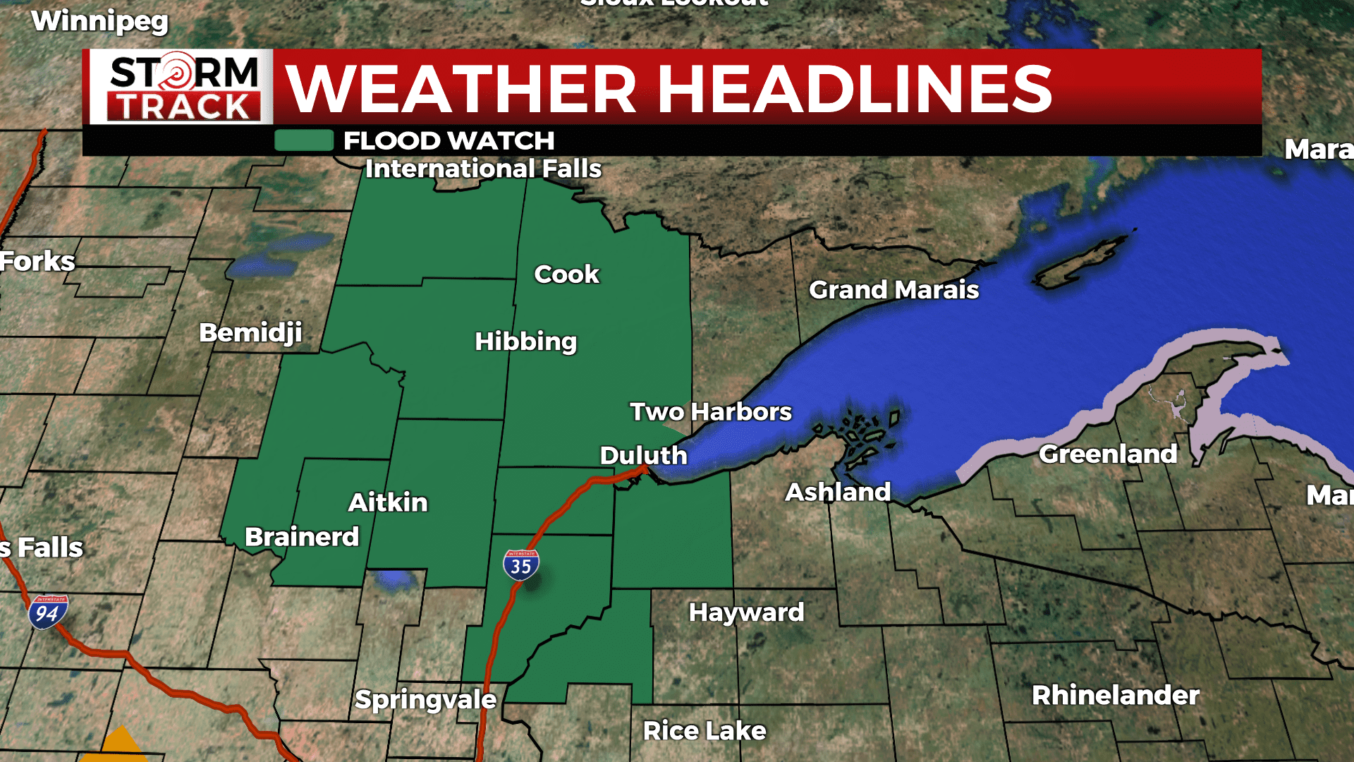
A Flood Watch is in effect for parts of northeast Minnesota. These areas could produce widespread rainfall totals 0.5-2 inches. Isolated areas could see up to 3 inches and minor flooding.
Once that moves out, quiet and drying weather expected through the weekend. Some early morning fog is possible all over through the weekend. There could be some very light afternoon rain showers Saturday over the far MN Arrowhead and portions of NW WI.
Seasonal to slightly below normal temperatures in the 50s to 70s with dewpoints dropping into the 40s on Sunday. The good news is we will see plenty of sunshine through the holiday weekend and for the first week of school.
TONIGHT
Showers and thunderstorms, mainly before 10pm. Some of the storms could be severe and produce heavy rainfall. Fog moves in after midnight, Low around 53. Breezy, with a southeast wind 10 to 15 mph becoming west after midnight. Winds could gust as high as 20 mph.
FRIDAY
Sunny, with a high near 76. Breezy, with a west wind 10 to 15 mph, with gusts as high as 25 mph.
SATURDAY
Sunny, with a high near 79. Breezy, with a southwest wind 10 to 15 mph, with gusts as high as 25 mph.
SUNDAY
Sunny, with a high near 69. Northwest wind around 10 mph, with gusts as high as 20 mph.
LABOR DAY
Sunny, with a high near 71. Light west wind becoming southwest 5 to 10 mph in the morning.
TUESDAY
Mostly sunny, with a high near 74. Breezy, with a south wind 10 to 15 mph, with gusts as high as 20 mph.
WEDNESDAY
Mostly sunny, with a high near 77. Southwest wind around 10 mph, with gusts as high as 20 mph.
THURSDAY
A slight chance of showers. Mostly sunny, with a high near 75. Southwest wind around 10 mph, with gusts as high as 15 mph.