Breaking down the timeline for this weekend’s storms
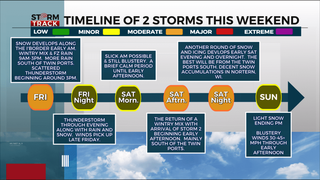
We are on the verge of having two messy spring storms impact the Northland. The timeline above has been provided to help you navigate your plans for the weekend. Let’s break this down. These two systems will impact the region Friday through Sunday.
ROUND ONE: FRIDAY NIGHT INTO SATURDAY MORNING
*Precipitation will develop first over far northern MN tonight, then further south and east through the
Northland on Friday.
*The chance for accumulating snow is greatest over far northern Minnesota tonight.
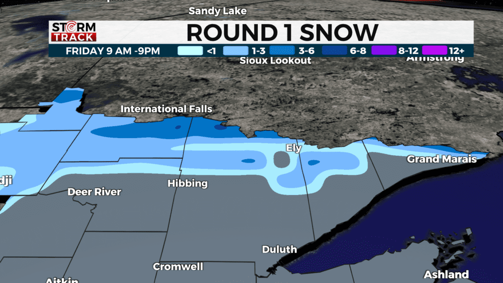
*These amounts may change depending on the amount of mixed precipitation that occurs.
- A wintry mix along with freezing rain begins around 9 am Friday and goes until 3 pm.
- Thunderstorms pop up mainly to the south by the afternoon where hail will be the biggest threat
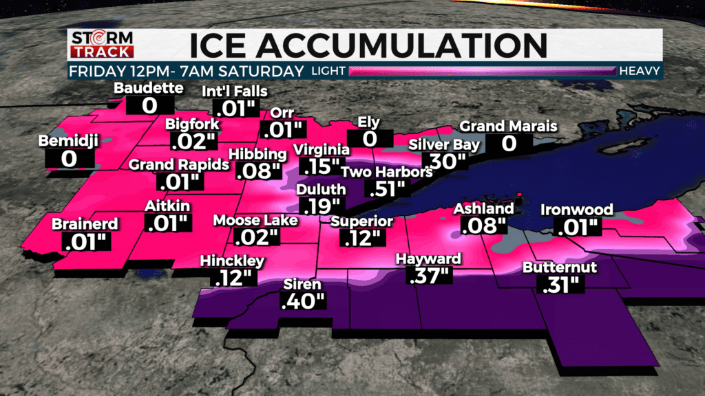
- Wind will pick up intensity off the lake heading into Saturday morning.
- Friday night into Saturday morning will see the worst of ice accumulations where any given area could see .05″ to .15″, especially the north shore.
During the day, we get a break from all the action and then round two arrives Saturday night into Sunday.
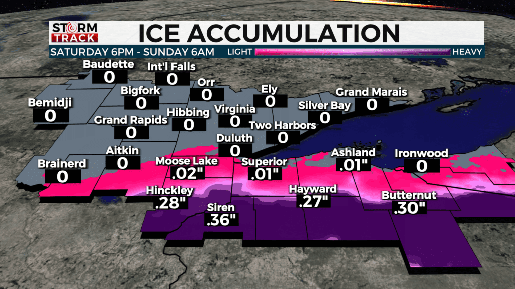
ROUND TWO: SATURDAY NIGHT THROUGH SUNDAY
*Another round of snow and icing develops early Saturday evening & overnight.
- The heaviest snowfall during this timeframe will likely be from the Twin Ports southward through Wisconsin.
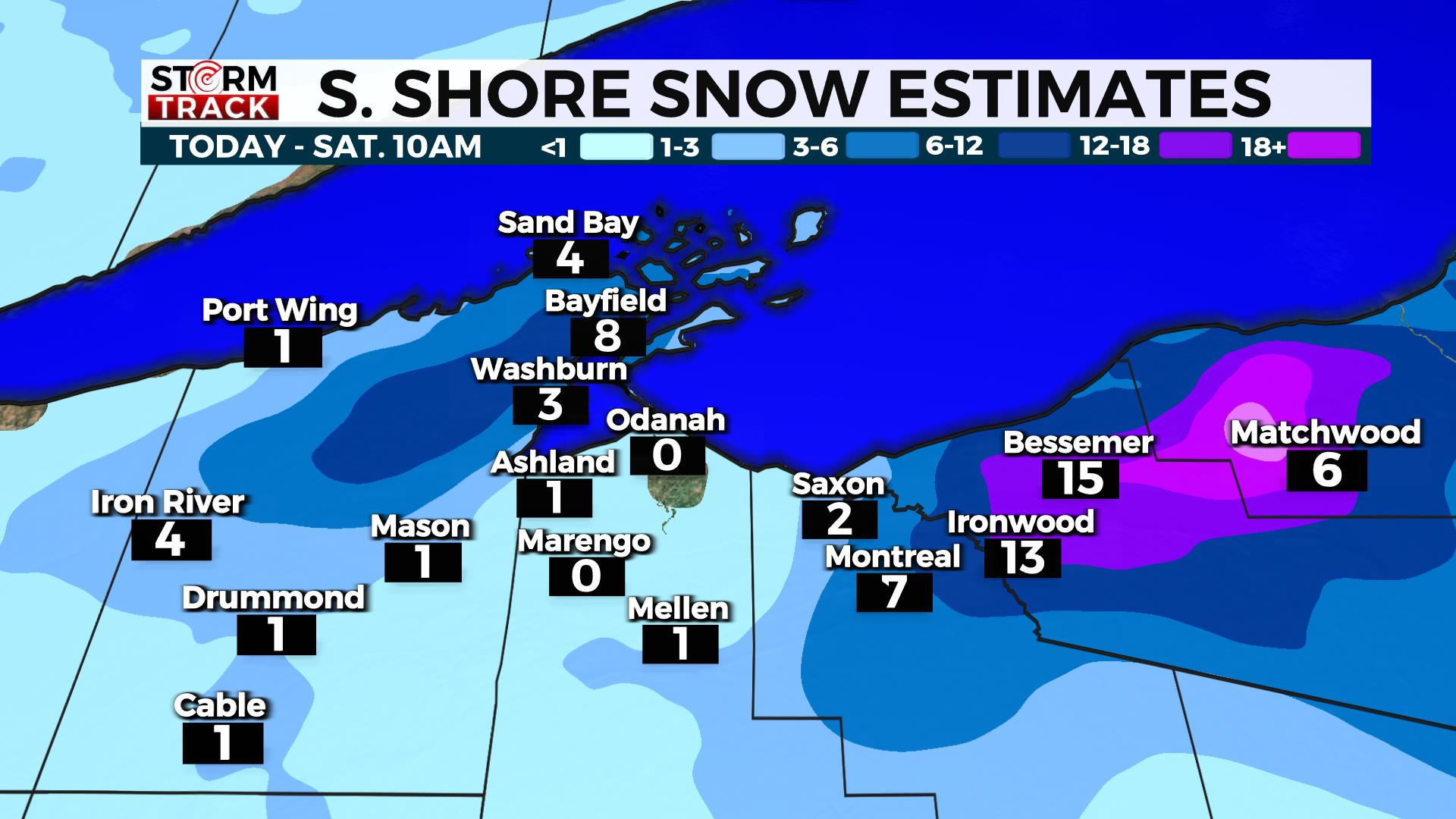
Please keep in mind winds off the lake will dictate snow amounts and locations. Sunday morning travel will be slick and more icing is possible to our south.
.
Round two will slowly begin to wrap up Sunday evening into Monday morning.